Alexandria's founded by Alexander

Alexandria's founded by Alexander the Great (by year BC): 334 Alexandria in Troia (Turkey) - 333 Alexandria at Issus/Alexandrette (Iskenderun, Turkey) - 332 Alexandria of Caria/by the Latmos (Alinda, Turkey) - 331 Alexandria Mygdoniae - 331 Alexandria (Egypt) - 330 Alexandria Ariana (Herat, Afghanistan) - 330 Alexandria of the Prophthasia/in Dragiana/Phrada (Farah, Afghanistan) - 330 Alexandria in Arachosia (Kandahar, Afghanistan) - 330 Alexandria in the Caucasus (Begram, Afghanistan) - 329 Alexandria of the Paropanisades (Ghazni, Afghanistan) - 329 Alexandria Eschate or Ultima (Khodjend, Tajikistan) - 329 Alexandria on the Oxus (Termez, Afghanistan) - 328 Alexandria in Margiana (Merv, Turkmenistan) - 326 Alexandria Nicaea (on the Hydaspes, India) - 326 Alexandria Bucephala (on the Hydaspes, India) - 325 Alexandria Sogdia - 325 Alexandria Oreitide - 325 Alexandria in Opiene / Alexandria on the Indus (confluence of Indus & Acesines, India) - 325 Alexandria Rambacia (Bela, Pakistan) - 325 Alexandria Xylinepolis (Patala, India) - 325 Alexandria in Carminia (Gulashkird, Iran) - 324 Alexandria-on-the-Tigris/Antiochia-in-Susiana/Charax (Spasinou Charax on the Tigris, Iraq) - ?Alexandria of Carmahle? (Kahnu)
Showing posts with label Pelium. Show all posts

Friday, April 14, 2023

Confusion about the name of Dardanus

As a general rule, the tribes living north of ancient Macedonia were known as Illyrians (see: A closer look at Illyria) and more to the east as Thracians (see: Thracian treasures at Alexander’s northern border). Some of those tribes are mentioned by name in Alexander’s conquest of Asia. 

I previously wrote about the Paeonians (see: About the Paeonians), and I want to concentrate on the Dardanians this time. 


[Damastion coin 380-360 BC - Picture from Military Wiki-Fandom]

King Bardylis I was the founder of the Dardanian Kingdom, which corresponds to modern Kosovo. In 393 BC, he dethroned King Amyntas III of Macedonia to place one of his henchmen in his place. Macedonia’s king Perdiccas III decided to take the Dardanian-occupied territory back, but he was defeated and killed. As the newly elected king, Philip II, his brother, married Bardylis’ granddaughter, Audata (see: Start of Philip's reign - Macedonia forged by Philip II). He killed old Bardylis on the battlefield in 358 BC. 

On his return home from the Danube campaign, Alexander faced the Illyrian revolt led by Bardylis’ son, Cleitus. The king defeated Cleitus at Pelium (see: Alexander’s psychological warfare), and the Dardanians were generally absorbed by the Illyrians and are no longer mentioned in history. 

However, a very different Dardanus is known as the son of Zeus. He was the mythical founder of Dardanus or Dardania on the Hellespont. Dardanus’ grandson Tros gave his name to the Trojans, and his son Ilus founded the city of Ilium, modern Troy. King Priam, the last king of Troy, would trace his lineage back to Dardanus. A pedigree worthy of any king!

Wednesday, February 18, 2015

Along the Via Egnatia: Apollonia in Illyria

The Via Egnatia, as mentioned earlier (see: Via Egnatia, a road to remember), was built by the Romans in the 2nd century AD and served as a major connection between Byzantium and Rome. As far as the Illyrian part is concerned, the road came from Ohrid (Republic of Macedonia), then ran through Elbasan, where it split in two, one arm connecting directly to Dyrrhachion (Dürres) and another one crossing Apollonia and Antipatrea (Berat) to end also in Dyrrhachion on the Adriatic coast where ships ferried people and goods to Brundisium (Brindisi) on the Italian side. 

To name a city after the sun god Apollo seems to have been very popular in Greek history as we find several cities by the name of Apollonia in Turkey (Lycia, Mysia, Pisidia, etc.); in Sicily, Italy; in Greece itself (Thessaloniki, Chalcidice, Kavalla, etc.) and in Crete; in Libya, where it was the harbor of wealthy Cyrene; and finally here in Illyria, modern Albania.

This time, I’ll be concentrating on Apollonia in Albania, located about 7 kilometers from Fier (see: Alexander’s psychological warfare in Pelium, Illyria). The city is well documented during Roman times, and the remains are obviously very Roman too. For Alexander, this was deep into the Illyrian country, just beyond the northern border of Epirus.

The original name was Gylakeia, after its founder Gylax, who belonged to the Illyrian tribe of the Taulantii. It was the Greek colonists migrating from Corinth and Corfu in 588 BC who changed the name to Apollonia. They were the ones who controlled the city and ruled over the Illyrians. Money was made from the slave trade and agriculture, but maybe mostly through the supply of asphalt, which was a valuable material for the caulking of ships in antiquity. Located on a branch of the Via Egnatia, it is obvious that it was an important harbor along the Illyrian coastline to link up with Brindisi on the other side of the Adriatic Sea and a transit port for all kinds of goods traveling between Byzantium and Rome.

This is the area where King Pyrrhus (a great-nephew of Olympias and cousin of Alexander the Great) ruled roughly from 306 to 272 BC while mingling in Macedonian affairs in the wake of the Diadochi Wars. He tried to keep the Romans out of Illyria, but by 229 BC, they firmly established themselves. I find it rather strange that Apollonia, like so many other Illyrian cities, was so loyal to the Romans. Maybe that is because the city was rewarded with the booty taken from their defeated King Gentius of Illyria – not very patriotic, I would say. By 148 BC, Apollonia became part of the Roman province of Macedonia, Epirus Nova. About a century later, the city supported Julius Caesar in his war against Pompey but fell into the hands of Brutus in 48 BC. Apollonia could also claim to have contributed to the education of Emperor Augustus, who studied at its famous school of philosophy in 44 BC, where Athenodorus of Tarsus was his teacher. Together with other cities in the area, Apollonia flourished and was even mentioned by Cicero as “magna urbs et gravis”, meaning “a great and important city”. Strabo also mentions the city in his Geographica as “an exceedingly well-governed city”. Decline set in during the third century AD when its harbor started silting up after being hit by a severe earthquake, which changed the course of the Aoos River. The inland turned into an ever-growing malaria-ridden swamp, and the inhabitants moved out to resettle at nearby Avlona (modern Vlore).  Only a small Christian community that moved in during the very early days of Christianity remained; they may have built the first church of Saint Mary. Today’s church dates from the 14th century and houses the local museum.

The visitor’s attention is immediately drawn toward a colonnaded façade that could be part of a temple. Still, it turns out to be the entrance to the Bouleuterion from the second century AD – quite unusual since generally, the tiers of such a city council survive but not the portal. The columns are definitely Corinthian, and in the architrave above them, we can still read the Greek dedication: “To the memory and in honor of Valentinus Villius Furius Proculus from his brother Quintus Villius Crispinus Furius Proculus, prefect of a cohort in Syria, tribune of the Legion Gemina in Pannonia, and president of the sacred games. A fight of 25 gladiators was held for the inauguration.” This Bouleuterion is surrounded on three sides by rooms, some kind of annexes to the Ionic Temple next to it. What is left are mainly low walls, and archaeologists suppose that these rooms were used for administration or for the priests’ duties. The outlines of the temple itself are easily located with a few columns sticking out from the grass.

Across from the Bouleuterion are two big stumps of stone indicating the site of a triumphal arch at the end of the street leading into Apollonia and dating from the 3rd century AD. To the right, but difficult to make out, are the remains of a Library from the 2nd-3rd century AD, proof of the city’s importance – if needed. On the other side of the street lies an Odeon that has been carefully restored and could hold as many as 650 spectators. Adjacent is a small Sacellum, an open sanctuary dedicated to an imperial cult. The niche was most probably flanked by two Ionic columns, and we still can see the rosettes and lion paws of their base.

It is followed by a portico, 78 meters long, punctuated by 17 niches that once held marble statues. This portico seems to date from the 4th century BC and was divided lengthwise into two by a row of Doric columns, whereas the outside columns were of Ionic style. I am told that this kind of structure is unique for Apollonia.

The portico ends at the Sacred Road, where we find a temple right around the corner, dating from the second half of the 2nd century BC but probably renovated four centuries later and possibly dedicated to Jupiter, Juno, and Minerva. The Sacred Road continues further uphill to the Acropolis, where little or no excavations have been done. With a width of nine meters, it is the widest street so far in Apollonia, paved with river pebbles laid directly on the clay surface.

On the other side of this Sacred Road are three vaulted shops, almost square in shape (3.45x3.40m), whose entrance could be closed by heavy double doors. The walls were very thick to keep out the moisture and guarantee a nearly constant temperature in order to preserve the goods stocked inside. They seem to have been built during the second half of the second century AD. Against these shops, another construction deserves our attention, for this is a water cistern that was used from the 4th century BC all the way to the 2nd century BC and has still kept its impermeable inside coating.

Opposite this Sacred Road are the remains of a large villa, in fact, no more than a succession of mosaic floors. The house was divided into four parts: an entrance portico of 14x5.8 m right opposite the Sacred Road; the main room measuring 12x11.8m with a center of white mosaics surrounded on all four sides by a corridor 2.9 m wide paved with little brick squares of 5x5 cm; the back room overlooking the sea. It is thought that this house was used as a gathering place for the believers before starting their procession over the Sacred Road. The most precious mosaics have been covered, of course, but the remaining ones are quite interesting. The attentive visitor will also notice the clearly Roman sewage system running parallel to this building.

Like every single Greek city, the location of Apollonia was chosen with the greatest care, overlooking the Aoos River and its fertile valley with the Adriatic Sea at the far horizon.

My greatest surprise, however, was the local museum, housed in the 14th-century monastery attached to the church of St Mary, by itself worth a visit. Under the watchful eyes of the soaring Pantocrator, it is easy to discover all sorts of antique fragments: Corinthian capitals placed upside-down to serve as a base for some Christian relic or flowers; the marble wall of a well with deep gutters left by the ropes that pulled the water-buckets over the centuries and now on dry land; small lidless sarcophagi turned into mini-gardens; and other spolia spotted in the outside walls. In the upstairs portico leading to the very entrance of the museum, several grave steles and smaller altars have found refuge.

Since I have been walking through Roman Apollonia, I expect this museum to reflect that image. Well, not entirely so, for originally, the city was founded by Greeks who imported the art from their hometowns or created their own imitation. I walk among Attic vases and hydras from the 5th century BC, Apollonian bottles and pots, but also some Italic imports. The Hellenistic period is also very present with several marble steles, reliefs, busts, and statues, but the eye-catcher is this wonderful shield that I immediately recognize as Macedonian. But wait a moment … according to the label it seems to be Illyrian! How on earth is that possible? I take a closer look at this splendid piece with three concentric circles in its center, around the frightening head of a Gorgon in Classical Greek style, sticking out its tongue and staring at me with shiny inlaid eyes. The border of the shield also counts three concentric rows of circles framing six half-circles around the edge. I fail to see what makes it Illyrian and inquire with the museum director, who tells me that the difference lies in the curving. Well, I suppose he knows, but I am not entirely convinced till I see other examples of Illyrian shields later on in Tirana and at the Skanderberg Museum. I’m totally baffled by this revelation! Ironically, the Illyrian shield in Apollonia is presented next to a splendid Macedonian helmet that has been dated to 314-312 BC, a rather narrow timeline.

So, all in all, Apollonia was definitely worth a visit, including the local museum. Some artifacts, however, have been moved to the national museum at Tirana, where I discovered a hoard of silver drachmae from the 1st century BC, as well as a head of Demosthenes (1st century AD) – of all people, what is he doing here?

I’m not too far away from Alexander, after all!

Thursday, January 15, 2015

Alexander’s psychological warfare in Pelium, Illyria

The name Selca e Poshtme in Albania did not ring any bells, and I was quite surprised to learn that this was an Illyrian necropolis and a royal one on top of that. I had no idea what an Illyrian tomb would or could look like, as I had never seen one before. But as soon as I stood in front of these tombs cut out of the face of the rocky wall, I felt at home right away, for they looked so familiar. I would have sworn they were Macedonian! 


I mentioned this site in my earlier travel story through Albania (see: Looking for Illyrian remains in Albania). Still, it deserves more attention since it is unique, more so since Selca e Poshtme is thought to be ancient Pelium.

For a start, there are five tombs, all belonging to the 3rd and 4th centuries BC. The oldest of these tombs is rather plain, with a rectangular burial chamber behind the usual antechamber, and is clearly related to the monumental Macedonian graves from the second half of the fourth century BC.

The next tomb was built around 270 BC and proudly shows a monumental façade of 6.4 meters wide and 3 meters high with an Ionic portico. This type of grave, otherwise unknown, has an open chamber in its center that was only used as a cenotaph (no body inside), but underneath the mosaic floor in front of the façade was the actual burial chamber where bones and urns were found together with some grave goods. The narrow alcove contained two sarcophagi decorated with reliefs shaped like a mortuary bed. Unfortunately, this tomb was looted towards the end of the third century BC, making it impossible to connect it to any specific person who must have been of high importance. On either side of the half-circular top entrance, a relief has been added between the two Ionic columns; on the left, we see a helmet, typically referring to Hellenistic rulers, and on the right, there is an Illyrian shield (looking very Macedonian!). This shield seems to connect the tomb with a local king. On the other hand, the helmet is nearly identical to the one found during WW1 near Lake Ohrid (now at the Antike Sammlung Museum in Berlin) that carries the inscription Basileos Monouniou, i.e., "of King Monounios." Sadly, there is no way to ensure that both elements belong together, but it certainly indicates that Monounios' rule reached as far as the Lyncestian lakes.

There are two other relatively simple tombs, one of which is characterized by a vaulted chamber in Macedonian style from the late 3rd century BC, and the other from the second half of the 4th century BC, showing a finely decorated "death bed."

Another spectacular tomb is the last one in the row, which is shaped like a miniature theater and belongs to the third century BC. The tomb proper is dug under the center stage, so to speak, making believe that relatives could gather around the deceased seated on the surrounding tiers. Presently, the tomb is filled with groundwater that mirrors the theater effect weirdly.

Yet, why are these tombs here, and where does this King Monounios fit in? The site of the necropolis is that of an old quarry that was used by the citizens to build their city and walls. This is supposedly the ancient city of Pelium, perched high on an acropolis that overlooks the River Shkumbin. In the middle of the 4th century BC, the Illyrian city was protected by a wall and must have been buzzing with life. The fact that these tombs are so close to the city is an indication by itself that they must be royal ones.

Pelium is indeed mentioned by Arrian as a border fortress when Alexander the Great crossed the area on his way back from the Danube campaign in 335 BC and faced the Illyrians' revolt. Cleitus, the formidable king of the Dardanians (from around Kosovo), had persuaded the Autariatae (from around Bosnia) to join forces to attack Alexander on his march, and even the Taulantians (from around Tirana) were willing to join Cleitus. Alexander had to act quickly to avoid being enclosed on all sides and promptly reached Paeonia (Skopje), crossed the plains of Florina to the heart of Illyria at Pelium, where Cleitus was holding this fortress. The Macedonian king arrived before Glaucias, king of the Taulantians, could join forces with Cleitus. According to Arrian, the town was surrounded by thickly wooded heights of which nothing much remains. Cleitus' troops were posted in these woods from where they hoped to attack the Macedonians. Still, as soon as Alexander charged, the enemy abandoned their protected position and fled inside the walls of Pelium, where Alexander kept them under close watch.

As he was getting ready to attack the city, Glaucias and his sizable force of Taulantians appeared on the nearby wooded hilltops, putting Alexander between two fires. He was in a precarious position, for his only way out was a steep, narrow path above the river. So Alexander played one of his masterly psychological cards. He drew the main body of his infantry in a massive formation 120 men deep, with on either wing 200 cavalrymen with the orders to obey his orders smartly. The heavy infantry was then commanded in a succession of maneuvers, pointing their spears forward and upward and making right and left turns. The entire phalanx then moved forward, wheeled around at each command, and executed a series of intricate movements. The enemy was shaken by this display of discipline and left their position on the lower slopes. At this stage, Alexander called his men to raise the battle cry and to clash their spears against their shields. It must have been a frightening sight and sound for the Taulantians, who hastily sought shelter under the city walls.

A reduced party, however, was still holding a hilltop that was in Alexander's way. He sent out a small detachment of Companions and personal guards in their direction, but upon their approach, the enemy withdrew. Alexander then occupied the hill and ordered about 2,000 men to cross the river and form a solid front on the other bank facing the enemy. Meanwhile, Alexander stayed put on his hilltop, keeping a watchful eye on the wooded area where Glaucias and his troops had retreated. Surely enough, as soon as the natives saw the Macedonians crossing the river, they seized the moment to attack Alexander and his party before they followed. Alexander reacted immediately with a counter-attack while the infantry raised their battle cry from the river below. The enemy's ranks broke, and Alexander quickly instructed his party to advance at the double to the river. He was the first to cross to set up his artillery on the riverbank. He ordered them to fire with every possible missile as far as they could to stop the enemy, while at the same time, he had his archers, who by now were mid-stream, shooting their volleys in the same direction. Glaucias was no fool and held his army out of range. The Macedonians reached safety without any casualties.

Three days later, Alexander, upon learning that Cleitus and Glaucias had not posted sentries around their nearby camp, which was not even protected by a palisade or a trench, immediately decided to attack them by night. Caught by surprise, the enemy had no time to organize a defense, and many were killed on the spot, while others fled in panic. Alexander pressed his enemies far into the Taulantian Mountains. Cleitus moved to Pelium and set it afire before seeking refuge with Glaucias. For now, Alexander had at least one enemy less to face.

At this time, a more pressing matter demanded his attention: Thebes had revolted and called the other Greeks to end Macedonian rule. To motivate their cause, the Thebans went even so far as to spread the rumor that Alexander had died in Illyria! This required a drastic change of plans, and luckily for Alexander, the Illyrians did not raise arms against him again. Within two weeks, Alexander appeared before the walls of Thebes, but that is another story.

The early years of Alexander's kingship are widely ignored, and Arrian seems to be the only source to mention the young king's northern campaigns – no wonder the name of Pelium (even less Selca e Poshtme) didn't ring a bell with me right away. But isn't it exciting when names and places can be tied together in such an unexpected way? Archaeology in Albania is still in its infancy, it seems, and excavations are merely carried out by the French or Italians. There is still a lot of work to be done here in Pelium. So far, our knowledge is based on Arrian and coins found in cities like Apollonia (Albania) and Epidamnos/Dyrrhachion (modern Dürres, Albania). Still, I feel confident that one day the history of Hellenistic or even Classical Greece in this country will be revealed. That will be my day, of course!


Standing here in this desolate and isolated landscape, it is hard to believe that a grand capital like Pelium once crowned this very hill above the Illyrian necropolis or that it was linked by important roads to other cities of the ancient world. In Roman times, it became one of the many stops along the famous Via Egnatia, whose trail is still easy to follow.


[Photos 1 and 2 are courtesy of Wim]
[More pictures can be found by clicking on this link of mine]

Thursday, January 1, 2015

Looking for Illyrian remains in Albania

Albania sounds to be the right place to find traces of Illyria, if any are to be found. 

We know that Alexander spent time in Illyria, but not where. There were no cities of importance, but people scattered around in small tribes, fighting among themselves and invading Macedonia on a regular basis in search of fertile land. The borders of Illyria were not clearly drawn. Those of today's Albania are but don't match either with old Illyria, although roughly in its center, nor with Epirus in the south, where it is shared with Greece.

Honestly, I don't know what proof of Illyria I can find or will come across, for they had no alphabet, cities, or art of their own – at least to my knowledge. Albania is not making things easier either, since the country has been locked away for half a century with a totalitarian regime that can only be compared to North Korea. It is now trying to emerge in the hope of meeting Western standards, although the Albanians have only scant notions of what that means, especially those living in the eastern mountains, where time has come to a standstill. I am on a general tour of one week, which is supposed to touch base with the key periods of Albania's history, the Macedonians and Greeks, the Romans and Byzantines, the Ottomans and Skanderberg (National Albanian Awakening), the Slavs, King Zog with WW1, the many foreign rulers during WW2, and the authoritarian communist regime under Enver Hoxha. An extremely long and varied timeline, although I am interested only in the very first centuries. Whatever I'll learn about the Illyrians themselves and the Macedonian occupation is a welcome bonus.

In a previous blog about the Illyrians (see: A closer look at Illyria), I summarized the roles played by King Philip II of Macedonia and his son, Alexander the Great, in putting Illyria on the map. After becoming king of Macedonia, Philip prioritized signing a treaty with the Illyrians, including his marriage to Audata, King Bardylis' granddaughter. This was only a way to win time because one year later, Philip marched north. He met the Illyrian army near Lake Ohrid, where he was victorious, and demanded that the Illyrians pull out of Upper Macedonia north to Lake Lychnitis. Alexander, in turn, sought refuge in Illyria after the brawl during his father's wedding to Cleopatra, Attalus' niece, in 337 BC. Attalus brought a toast to a lawful successor of Macedonia, implying that Alexander was a bastard. We know how Alexander reacted, especially since his father took Attalus' side. This was when Alexander left for Illyria, taking his mother, Olympias, to the safety of her brother's court in Epirus.

Peace with Illyria lasted while it lasted, for as soon as they heard that King Philip was assassinated in 336 BC, they felt free from any obligation towards Macedonia. Alexander could not afford to have these troublesome tribes raiding his northern borders while preparing to cross to Asia. So, as soon as the most urgent matters were settled in Pella, Alexander took his army north and not only defeated the Illyrians but also mopped up all the resistance. Ultimately, the Illyrians became faithful allies and fought at his side throughout his Asian campaign.

I am curious to see the landscape Alexander crossed to understand where he may have been during his self-imposed exile. I will soon be rewarded when we drive over the most horrible road from Pogradec to Gjirokastra through the mountainous region of southeastern Albania.

Pogradec lies on the crossroad linking Tirana, the Albanian capital, to Elbasan and Korce and on the southern bank of Lake Ohrid, where King Philip made history. This was an essential stop along the Via Egnatia in antiquity that connected Byzantium to Rome. Today, Lake Ohrid is shared between Albania and FYROM (meanwhile renamed the Republic of Northern Macedonia). It is one of the three geological wonders in the world, harboring endemic species that cover the entire food chain. As we drive down to the shores of the lake, the views are superb, and I am impressed by the sheer size of the lake; it must have looked like a sea to people in antiquity. Unlike the more inland parts, our stop in Ohrid has a very Mediterranean feeling. But Alexander has been remembered in these parts, for I find restaurants and wine carrying the name Aleksandrija.

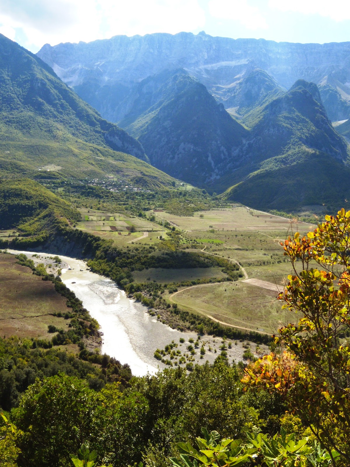
The next day we pick up the main road from Korca south to Gjirokastra, but our maximum speed on this bumpy, degraded, deteriorated, and unmaintained road is 25 km/hour. It takes us all day to get there, but nobody is complaining, for the landscape is absolutely breathtaking! There are no cities or towns, hardly an occasional cluster of houses, recent constructions next to dilapidated shacks that may be stables or housing, who knows. Small gardens, a few fruit trees, a couple of cows, and donkeys are all that people have to live on. I am told that in winter, the snow is two meters deep in these parts, making it impossible for cars or buses to get through. Even today, there is no regular bus service in those parts – how isolated can one live? Was it like this in Alexander's days, I wonder. It cannot have been much better, if any, for the land and weather are still what it was. No wonder the Illyrians were envious of the fertile plains of Lower Macedonia! Overall, the landscape is green with a wide assortment of trees and low bushes between patches of rocky grassland framed with high, barren peaks. Occasionally, a river or stream meanders through the valleys, reflecting the sunlight or threatening clouds. The productive patches of land along those waterways are thriftily cultivated, a pleasant sign in this otherwise austere land.

Then we reach Gjirokastra, whose Greek name is Argyropolis (meaning silver castle), which must have been a fortified place in Epirus (yes, we are in Epirus here!). The oldest finds so far are the city walls from the 3rd century AD. The remains of today's citadel, built between the 6th and 12th centuries, still command the otherwise Ottoman city.
It is funny when I come across a Rruga Antipatrea, which is the old name for Berat, and most probably, this street and city were named after Antipater. A restaurant proudly shows off the name Antigoni. What a shame that there are no written records in Illyria and that the Macedonians or the Greeks didn't bother to write about them.

The most rewarding moments of my tour were those when I faced Illyrian artifacts in the local museums. In Apollonia, I saw my first Illyrian shield from the 4th century BC, which looked so closely like a Macedonian one. I was told that the difference was to be found in its curving; whether that is true or not, I don't know, for it had the same semi-circles and the Medusa head in the center, complete with shiny inlaid eyes that intensified her glance. Another shield was shown at the Skanderberg Museum, with the same semi-circles but carrying the Macedonian star in its center, with an Illyrian helmet and some arrows and spearheads. More helmets were exhibited at the Archaeological Museum of Tirana, where a mold for an Illyrian shield was also displayed.


Yet, the most unexpected highlights are the Royal Tombs of Selca e Poshtme, a place in the middle of nowhere with no decent road leading to it. This is supposedly the ancient city of Pelium, perched high on an acropolis that overlooks the river Shkumbin. In the middle of the 4th century BC, the Illyrian town was protected by a wall, and its life was intensive. They made pottery out of grey clay imitating Greek shapes and decorations, created metal and bronze tools, and traded their goods over the roads along the river, which would later become the Via Egnatia. It was the residence of the Illyrian kings. However, excavations are still in an early stage, and Pelium's role is mainly based on the coins found in cities like Apollonia and Dyrrhachion (modern Dürres). The main discovery is four royal tombs right under the cliff of the Acropolis; definitely Illyrian but, at first glance, very Macedonian. More about these great tombs in my next post, Alexander's psychological warfare in Pelium, Illyria.


Last but not least, I should focus on the route followed by the Via Egnatia, although I have yet to come across any visible pavement like in Philippi, Greece, for instance. From Ohrid, it ran through Elbasan, where it split into two. One arm connected directly to Dyrrhachion (Dürres), and another crossed Apollonia and Antipatrea (Berat) to end at Dyrrhachion on the Adriatic coast. From here, ships ferried people and goods to Brindisi on the Italian side. I regret that I have not seen a remnant of this famous road, but have only been pointed to the line it followed through the cities. Maybe next time?

Friday, October 10, 2014

The King is dead, long live the King!

Most histories about Alexander the Great simply start with his kingship and immediately jump to his conquest of Asia. This is where he spent the most important part of his life and where the great battles were fought. Still, he could not have even considered this campaign had he not first settled the unrest in Greece and the Macedonian northern borders – a fact that is often omitted, unfortunately.

In July 336 BC, just twenty years old, Alexander unexpectedly became the new King of Macedonia, and his life was to take a new turn. The most pressing matter was evidently to consolidate his place on the throne and to eliminate all those who could have been involved in the murder of his father. Next, he had to consider and evaluate all the pretenders to the throne that could be a threat - among them was Amyntas, the son of Philip's brother Perdiccas, now a grown man. Alexander, however, spared his simple-minded half-brother Arrhidaeus. And …. His final priority was his father's funeral, the construction of a vast pyre set afire in the presence of the entire Macedonian army, and the transfer of his remains to his last resting place inside the Royal Tomb outside the walls of Aegae. – a tomb that was found intact in 1977 by Manolis Andronicos.

No doubt, Alexander was itching to move on in his father's footsteps and set out for Asia as soon as possible, but more urgent matters kept him in Pella for a while. Athens had rejoiced at Philip's death, and many other cities still resented that Philip's Macedonia ruled the Greeks as Hegemon of the League of Corinth, a title that Alexander inherited, much to their discomfort and sorrow.

With the support of the army, Alexander marched south into Thessaly, where his route was blocked at the Tempe Pass. Instead of attacking the Thessalians head-on, he simply marched around the pass, settling the opponent's resistance once and for all. As he won the support of northern and central Greece, Athens could only do the same, and they sent their pledges of support to the new king. Leaving Athens for what it was, Alexander traveled to Corinth to ensure all the Greeks swore their oath of allegiance as they had done to his father before.

Now that Greece was secured, Alexander returned home for the winter, planning his spring campaign in Thrace to settle the unrest among the Triballi and the Illyrians living along Macedonia's northern border. This would be his first test with the army and asserting his authority as king before crossing to Asia.

In the spring of 335 BC, he left Amphipolis and was soon met by the Thracians, who held the pass over Mount Haemus. The enemy had hauled wagons up the pass to let them thunder down on the Macedonian army as soon as they were within reach. Alexander assessed the situation and ordered the phalanx to open up their ranks to let the wagons run through; where there was no space for the soldiers to step aside, they were instructed to lie down on the ground and lock their shields over their heads. As a result, the Thracian wagons hardly did any damage. It should be noted that the army followed Alexander's orders, showing that they trusted their commander – a matter of detail but a crucial point! It is said that 1,500 Thracians were killed, and their women and children were sent to Macedonia to be sold as slaves.

Alexander's next goal was the Triballi, who lived along the southern banks of the Danube River. Their strength was their many well-concealed defensive positions, and Alexander first had to dislocate them to attack them in open battle. One such encounter happened in their refuge on an island in the middle of Lyginus River, and Alexander sent out a small contingent of slingers and archers to lure them out of their hiding places. This stratagem worked as he intended, for soon, the Triballi rushed out in force only to be met by the whole Macedonian army. About 3,000 Triballi were killed, and those remaining sought refuge on the island of Peuces in the middle of the Danube, which had natural defenses because of its high banks, rocks, and the fast-flowing river. Since a front attack would be too costly, Alexander decided to wait and simply cut off the enemy's supply routes.

Unexpectedly, the Getae from the plains north of the Danube showed up with a force of 10,000 infantry and 4,000 cavalry, which could not be ignored because of their sheer number. Alexander decided to cross the Danube overnight with 4,000 men and 1,500 cavalry, using some small boats but mainly using floating devices made from the Macedonian leather tents filled with straw. When the Getae discovered them at daybreak, they fled. The fight was over before it began, and Alexander simply destroyed their crops. This meant that the Triballi on their island were entirely isolated, and all they could do was surrender. And so they did, together with the stray Thracians and Celts from the Balkans.

Behind Alexander's back, the Illyrians now revolted. Cleitus, the formidable king of the Dardani (from around Kosovo), had persuaded the Autariatae (from around Bosnia) to join forces and attack Alexander on his march to meet him. Even the Taulantii (from around Tirana) would march to join Cleitus. Alexander had to act fast so he would not be enclosed on all sides. He foiled Cleitus' plan and marched to Paeonia (Skopje), across the plains of Florina, to the heart of Illyria at Pelium, where Cleitus was holding a fortress. The Taulantians did not arrive in time to join forces with Cleitus; Alexander was there first. When he learned that the Taulantii had not posted sentries around their nearby camp, he immediately attacked them by night. Caught by surprise, they surrendered, leaving Alexander with one enemy less to face. On his way to attack Cleitus, a more pressing matter demanded his attention: Thebes had revolted and called the other Greeks to end Macedonian rule! This required a drastic change of plans. Luckily for Alexander, Cleitus escaped from the fortress but did not raise arms against him again; the Illyrians even sent troops to join Alexander's forces in Asia.

The attitude of Thebes was of the utmost importance. Thebes was endangering Alexander's hegemony of the League of Corinth and breaching the basic constitution of the Treaty. Thebes had signed the Common Peace and could not legally revolt unless it faced the armies of all the other League members. Alexander must have felt that Thebes' revolt was putting his authority in the balance and, on a personal level, that they were hampering his plans to attack Persia.

Alexander force-marched his army south from Illyria, covering 400 kilometers in 13 days over mountainous terrain, crossing Mount Grammus, Mount Pindus, and Mount Cambunia, allowing his men only one day's rest in Thessaly. This was so fast (more than 30km/day) that even the Thebans didn't believe it was Alexander standing before their city gates! Athens, who at first had taken side with Thebes, now withdrew (freaking out, no doubt), leaving Thebes to fight the battle on their own from the well-fortified Cadmea, where the Macedonian garrison was still surrounded by the Thebans. In the battle that ensued and despite their fortified position, the Thebans had to give way to the Macedonians led by Alexander personally. At least 6,000 Thebans died in the last stand, and 30,000 were taken prisoner to be enslaved. Unsurprisingly, Alexander wanted to set an example for the other members of the League of Corinth. At the same time, he diplomatically left the punishment of Thebes to the League, which urged the city's total destruction. At this stage, I believe Athens got scared and sent an embassy to congratulate Alexander for his victory over the Illyrians, and probably against their will, with his punishment of Thebes. To cut the matter short, Alexander demanded several of their politicians to be handed over to him, men like Demosthenes, Lycurgus, and Hyperides, but Demades, another Athenian orator, was able to convince Alexander to change his mind. Well, after all, now that Thebes was razed to the ground and cities like Corinth and Chalcis were in his hands, he could be generous towards Athens, which no longer had any support from other cities.

It was time for Alexander to return home, and nobody dared doubt his leadership. He spent nine days at Dion, the Macedonian sanctuary at the foothills of Mount Olympus, to feast in honor of the Muses and Zeus. He held several banquets in his royal tent that could fit one hundred couches, a true feast, Macedonian style. The vast plain at the foot of the old Greek theater is still there to kindle our imagination.

Back home, games were organized to honor the Olympian Zeus at Aegae. It was here that he issued the first coins bearing the image of Alexander; this was in 335 BC. He was now indeed King of Macedonia, feared and/or respected by all of Greece. He could now concentrate on the invasion of Asia. That is how he spent the winter, and in the early days of spring 334 BC, he set his army in motion, leaving Macedonia in the hands of his Regent, Antipater. Alexander would never see his homeland again.