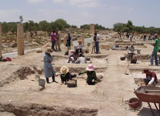
Alexandria's founded by Alexander

Alexandria's founded by Alexander the Great (by year BC): 334 Alexandria in Troia (Turkey) - 333 Alexandria at Issus/Alexandrette (Iskenderun, Turkey) - 332 Alexandria of Caria/by the Latmos (Alinda, Turkey) - 331 Alexandria Mygdoniae - 331 Alexandria (Egypt) - 330 Alexandria Ariana (Herat, Afghanistan) - 330 Alexandria of the Prophthasia/in Dragiana/Phrada (Farah, Afghanistan) - 330 Alexandria in Arachosia (Kandahar, Afghanistan) - 330 Alexandria in the Caucasus (Begram, Afghanistan) - 329 Alexandria of the Paropanisades (Ghazni, Afghanistan) - 329 Alexandria Eschate or Ultima (Khodjend, Tajikistan) - 329 Alexandria on the Oxus (Termez, Afghanistan) - 328 Alexandria in Margiana (Merv, Turkmenistan) - 326 Alexandria Nicaea (on the Hydaspes, India) - 326 Alexandria Bucephala (on the Hydaspes, India) - 325 Alexandria Sogdia - 325 Alexandria Oreitide - 325 Alexandria in Opiene / Alexandria on the Indus (confluence of Indus & Acesines, India) - 325 Alexandria Rambacia (Bela, Pakistan) - 325 Alexandria Xylinepolis (Patala, India) - 325 Alexandria in Carminia (Gulashkird, Iran) - 324 Alexandria-on-the-Tigris/Antiochia-in-Susiana/Charax (Spasinou Charax on the Tigris, Iraq) - ?Alexandria of Carmahle? (Kahnu)

Saturday, October 28, 2017

Another “laptop” in ancient Greek images?

An earlier blog, A laptop in ancient Greece? was a big joke as it was meant to be, but during a recent visit to the Louvre-Lens music exhibition I came across another “laptop” picture on an Attic red-figure oenochoe. This vase, dating from around 450-440 BC, shows the Muses Urania, Calliope and Melpomene, and is attributed to the painter Methyse. It was found in Etruria, Italy.

In order to recognize who is who, each Muse wears or holds her own attributes.

Urania was the Muse of Astronomy, usually holding a celestial globe and pointing to the stars with her little rod – maybe the seated figure in the center?

Calliope was the Muse of Music and poetry who normally holds a writing tablet in her hand. So she could be the figure on the left with what appears to be a laptop, right?

The third Muse Melpomene, the Muse of tragedy is usually portrayed with a tragic theater mask or a sword but the figure on the far right of this oenochoe looks more like playing an aulos (double flute).

Well, whatever the total picture, I have no problem identifying the left figure as Calliope who is not opening her writing tablet as we would open a book but she is holding it horizontally and opens it upwards.

Truly we should not take everything at face value!

Tuesday, October 24, 2017

More illegal mosaics from Apamea

When I wrote my previous blog, The unique mosaic from Apamea, I was not aware that there was more of the kind to follow. There is a much larger mosaic estimated to cover at least 19 m2 that is also high on INTERPOL’s list of illegal digs at Apamea in Syria.

Besides the panel discussed previously showing the foundation of Apamea by Seleucos I with his son Antiochus I, there are three more panels coming from the same source. Because of their size and magnificence, this entire mosaic is assumed to belong to a large room from a wealthy Roman residence. The top one depicts the foundation of Pella (as Apamea was called previously) by the legendary Archippos. The bottom panels illustrate the construction of a fortification wall around the city that holds monumental public buildings.

Based on the clandestine photographs of this floor, it seems that the very lower part and half of the central zone are missing. What remains is, however, of the highest quality and has been compared to the paintings from the tomb of Agios Athanasios (see: The Macedonian Tomb of Agios Athanasios in Thessaloniki) – not without ground.


The top mosaic portraying the religious foundation of Pella shows five Macedonian cavalrymen with their horses, shields, and spears on the right-hand side and five figures making cult offerings in the left corner. Three of these men have been identified as their names are inscribed in Greek. We read Archippos as the legendary founder of the city sacrificing a bull, flanked by Antipater and his son Cassander – all richly dressed in their best tunic and cloak and wearing a diadem.

The central part of the mosaic depicts the key moment of the foundation of Apamea, where Seleucos holds the ktistes, an architectural measuring instrument symbolizing him as being the founder. Around a large table filled with silver and gold coins, we find once again Archippos and Antiochus I, together with Antipater and Cassander, and most importantly, Seleucos wife Apamewho contributed lavishly to the construction of the city. All these figures are dressed in the same sumptuous outfits as mentioned above.

I fail, however, to understand the presence of old Antipater in the company of his not-so-beloved son Cassander. We will remember that Antipater named Polyperchon as his successor and not Cassander, so why would he have dragged his son along to Pella/Apamea? And for what reason would they both be present in Pella/Apamea in the first place? The article published in Popular Archaeology seems to place the entire scene around 321-319 BC when Antipater was regent and Cassander was the commander of the Macedonian cavalry in Pella/Apamea. Still, I wonder what their contribution was to the foundation of Apamea. The Roman vision of history in the 4th century AD, some seven centuries after the facts, appears to be shrouded in mystery.


The background of this mosaic is, however, as exciting as the figures in the foreground, to say the least. We see huge defense walls encircling the city. Inside those walls, there is a large roofed temple with a high pediment supported by five columns. This temple is flanked by several other smaller and roofed buildings. Also recognizable is the large hippodrome or Roman circus, not unlike the one that has been unearthed in nearby Gerasa (which was founded about the same time) with a central spina delimited by little turrets. The figures on the left bottom part of that section are less obvious. They seem to be men working on the fortification wall, and a large ox is pulling something heavy.

The very bottom of the mosaic depicts a more idyllic suburban scene with, on the right-hand side, a lovely Roman Bath. Two distinct entrances can be seen, one probably leading to the cloakroom used by two women with small children and the other opening up above a ramp from which children are sliding down into the pool below. Very important is, however, the large noria (waterwheel) depicted on the left of this section. Until now, it was generally accepted that the oldest norias dated from the 5th century AD, but this picture confirms that they were used already one full century earlier! Norias are still standing along the Orontes River in Hama (see: Hama and its norias), where in the 5th century, some one hundred of them were still functioning. This makes you wonder how many of them were aligned along that same river here in Apamea!

All in all, these mosaic scenes are very revealing while, at the same time, they rise many new questions. It is not surprising to find them among the most valuable objects wanted by INTERPOL. It would be great if these masterpieces could be recovered someday, enabling professionals to examine them more closely.

Friday, October 20, 2017

Damned dams!

After Allianoi (see: My Heart in bleeding for Allianoi), after Zeugma (see: Zeugma, border town along the Euphrates), and after many unchartered dams destroying our historical heritage, it is the turn to the town of Hasankeyf on the Tigris to be flooded and blasted to pieces because of the construction of yet another dam.

[Picture from Archaeology News Network]

The location of the dam on the Tigris River is a very unhappy one for Hasankeyf is one of the oldest continuously inhabited settlements in the world. From Neolithic caves to the Roman fortress and later Ottoman landmarks, all are soon to disappear forever as crews have already started blasting the surrounding cliffs in preparation for the construction of this dam.

As before in Allianoi and in Zeugma, the Turkish government does not listen to the pleas formulated by local and international communities to preserve the site. Internationally, it does not ring loud bells like when the giant Buddhas were blown to pieces in Bamyan, Afghanistan, or the more recent dynamiting of the Temple of Bell in Palmyra, Syria, but this heritage is nonetheless very important from the historical point of view.

Of course, officials have their own arguments and as usual they underscore the fact that this dam will enable the irrigation of the surrounding land and generate a substantial amount of energy. They even expect tourists to come for scuba diving in the new reservoir in search of the submerged monuments (as if the average tourist walks around with his diving gear in his backpack!). The price tag for this operation is, however, that nearly 200 settlements will be submerged and some 15,000 people will be resettled in the newly built city of New Hasankeyf on higher grounds.

It is comforting to hear that Ridvan Ayhan, who is a member of the Save Hansakeyf Initiative, confirms my earlier worries about the lifespan of a dam which is only 80 years on average. Nobody is asking the obvious question: and then, what? As I explained earlier when talking about Allianoi, water is of vital importance to our life but dams are not the one and only solution and they are not eternal as governments all over the world want us to believe. What will happen in 80 or 100 years from now when this barrage and so many others give way? No water then, no crops, no dams, nobody to take responsibility for, and sadly no historical city to be revived from underneath the sediments. How can we explain this to our children and our children’s children?

In December 2016, the HuffPost published a cry for help with large-sized photos of the area but as usual, officials turned a blind eye to this kind of plea.

Monday, October 16, 2017

Alinda, the refuge fortress of Queen Ada of Caria

From 545 BC onwards, Caria was part of the Persian Achaemenid Empire and as such was ruled by a satrap (governor). The most famous of them was Mausolus, who proclaimed Halicarnassus as his new capital – clearly a man with ambition and great visions. Mausolos married his sister Artemisia as was customary, and when he died childless in 353 BC, she continued ruling until her death. The power went to Artemisia’s younger brother, Idreus who had married his younger sister Ada. She ruled after her brother/husband died also. But there was still another younger brother, Pixodarus who hungered for the title of satrap and befriended the Persians. He expelled the widowed Ada from Halicarnassus and she sought and found refuge in her stronghold of Alinda, further inland.

Queen Ada managed to keep her independence in her fortress of Alinda but on Alexander’s approach in 334 BC, she decided to offer her surrender to the new conqueror and to adopt him as her own son – much to Alexander’s delight, no doubt. Alexander generously trusted Caria to Queen Ada who ruled over her country once again, except for the military affairs that were in the hands of a Macedonian garrison. She probably died in 323 BC, the same year as Alexander the Great.

Driving up to Alinda, it is quite clear that this is a very strategic location and the city’s defence walls running down into the fertile valley are there to prove it. The first constructions that welcome today’s visitor as he drives up from Karpuzulu are the remains of a Roman aqueduct with four arches still intact and a handful of scattered Carian sarcophagi. The heavily shattered and overgrown Roman theatre from the 2nd century BC lies on the other side of the hill, just above the impressive market building. This is probably the best testimony of Alinda’s importance and was three storeys high. The highest level touches the agora measuring 30x30 meters.

It seems Alinda, as capital of Caria died together with Queen Ada as it was the last stronghold of the Carians. However, the city did not lose its importance entirely for Antiochus III established a garrison there in the mid-3rd century BC but lost it to the Romans in the early 2nd century BC.

Thursday, October 12, 2017

A unique way to look at the Roman Roads

The article which I reproduce below and the accompanying map has been published by Sasha Trubetskoy. Clicking on this link will take you to a better view of the map which you can also enlarge. Enjoy!
It’s finally done. A subway-style diagram of the major Roman roads, based on the Empire of ca. 125 AD.
The lines are a combination of actual, named roads (like the Via Appia or Via Militaris) as well as roads that do not have a known historic name (in which case I creatively invented some names). Skip to the “Creative liberties taken” section for specifics.
How long would it actually take to travel this network? That depends a lot on what method of transport you are using, which depends on how much money you have. Another big factor is the season – each time of year poses its own challenges. In the summer, it would take you about two months to walk on foot from Rome to Byzantium. If you had a horse, it would only take you a month.
However, no sane Roman would use only roads where sea travel is available. Sailing was much cheaper and faster – a combination of horse and sailboat would get you from Rome to Byzantium in about 25 days, Rome to Carthage in 4-5 days. Check out ORBIS if you want to play around with a “Google Maps” for Ancient Rome. I decided not to include maritime routes on the map for simplicity’s sake.

Creative liberties taken

The biggest creative element was choosing which roads and cities to include, and which to exclude. There is no way I could include every Roman road, these are only the main ones. I tried to include cities with larger populations, or cities that were provincial capitals around the 2nd century.
Obviously to travel from Petra to Gaza you would take a more or less direct road, rather than going to Damascus and “transferring” to the Via Maris. The way we travel on roads is very different from rail, which is a slight flaw in the concept of the map. But I think it’s still aesthetically pleasing and informative.
Here’s a list of the roads that have authentic names and paths:
  • Via Appia
  • Via Augusta
  • Via Aurelia
  • Via Delapidata
  • Via Domitia
  • Via Egnatia
  • Via Flaminia
  • Via Flavia (I, II, III)
  • Via Julia Augusta
  • Via Lusitanorum
  • Via Militaris
  • Via Popilia
  • Via Portumia
  • Via Salaria
  • Via Tiburtina
  • Via Traiana
  • Via Traiana Nova
Some roads have real names but were modified somewhat:
  • The Via Latina I combined with the Via Popilia. In reality the Popilia ended at Capua, and the Latina went from Capua to Rome.
  • Via Aquitania only referred to the road from Burdigala (Bordeaux) to Narbo (Narbonne).
  • Via Asturica Burdigalam similarly only refers to the Astrurica-Burdigala section.
  • “Via Claudia” is not a real name, but refers to a real continuous road built by Claudius.
  • Via Hadriana was a real road in Egypt, but it refers to a slightly different section than the green route.
  • The name “Via Maris” is considered to be a modern creation, referring to real ancient trade road whose real name has been lost to history.
  • Via Valeria only referred to a section of the yellow Sicilian loop.
  • The roads around Pisae, Luna and Genua had several names for different sections, including Via Aemilia Scauri. Sometimes “Via Aurelia” referred to the entire road from Rome to Arelate.
  • Via Sucinaria is the Latin name for the Amber Road, a trade route from the Baltic region to Italy that carried amber as a valuable good. It probably was not used to refer to a single literal road.
  • Via Gemina and Via Claudia Augusta are real names that referred to small parts of the routes marked on the map.
The other roads have relatively uncreative names that I invented, usually based on a place that they pass through. I have never formally studied Latin and I’ll admit that I am somewhat confused by the distinction between -a and -ensis endings, so there’s a chance I may have messed that up.
As questions come up I will update this section.

Saturday, October 7, 2017

World Heritage Sites in Danger

The war in the Middle-East, especially in Syria, Iraq and Afghanistan is a terribly destructive one ( see: The War in Syria, what will happen to its heritage?; Loss of our Cultural Heritage in the Middle-Eastern Conflicts). Millions of people have been displaced and the number of habitations that have been shot down and blown to pieces can no longer be counted. Among the damaged constructions are – inevitably – irreplaceable ancient sites that belong to human heritage. They are pages of our history that are torn and lost forever.

In Syria and Iraq alone, UNESCO lists ten World Heritage Sites and of those ten, they say, nine are presently in danger. ISIS, although not the only destructive factor is definitely the main culprit.

The majority of the sites are located in Syria:


The well-preserved remains of Bosra on Syria’s southern border are less known but contained a great number of ancient buildings. Most famous is probably its Roman theater from the 2nd century AD when Bosra was the capital of the Province of Arabia. Yet there also are many testimonies from the days when the city was ruled by the Nabataeans, the Byzantine Empire, and the Umayyads. Bosra, however, was one of the first cities under siege and suffering from repeated shelling and bombing by ISIS (the theater was a  choice location for the snipers).

Another sore spot is the ancient city of Aleppo, which like Palmyra was situated on antique trading routes (see: Tracking Alexander from Tyre to the Euphrates) and remained a major city in Syria. Since 2012, it has been divided alternately between rebels and government troops. Among the destroyed and damaged buildings is the Mosque of Aleppo and its Minaret from the 11th century AD (see: Desperation of the Archaeologists).

Less known but certainly as important are the so-called Dead Cities with their precious villages and churches that flourished between the 1st and the 7th centuries ranging from antiquity to the end of the Byzantine era. Fighters and refugees alike sought shelter among these ruins, trying to accommodate the fragile remains to their needs.

From another time-frame are the many Crusader Castles, the most renown being the Crac-des-Chevaliers. They are unique because of their mixed architecture of European and Eastern influences. Here too, the Syrian army and the rebels occupied the premises in turn without any respect or consideration for the patrimony.

Last but not least, there is the damage done in Damascus, one of the most ancient cities in the world. Damascus already was a problem child because of a population decrease and people moving from older building to newer housing facilities. This left big gaps in some of the city’s neighborhoods. The fighting inside the Old City started as early as 2012 and caused more damage. UNESCO has counted as many as 125 protected monuments in Damascus, among which the famous Umayyad Mosque, one of the largest mosques in the world.

UNESCO also lists a number of precious buildings in Iraq. Unfortunately, these are less known by the general public simply because traveling into Iraq was and is problematic.

The city of Hatra was one of the best surviving examples of a Parthian city founded in the 3rd or 2nd century BC. Most of its city walls and towers, as well as the sacred temenos of the Temple of Mrn, were still standing when ISIS arrived. As they did in nearby Nimrud a few days before, they hacked down the magnificent figures that decorated the arches and vaulted passages. The Great Temple was a rare example of combined Greek, Roman, Persian and Arabian architectural styles.

The Assyrian city of Assur on the western bank of the River Tigris is another precious site as it was the first capital of the Assyrian Empire. Assur existed for nearly four thousand years and was finally destroyed by the great Tamerlane. However, the stately Parthian Palace and Temple have survived into our 21st century until they fell under threat of ISIS. The fate of Assur remains uncertain for if the city is not destroyed by terrorists it may become victim to the dam project on the Tigris which will flood whatever walls that are still standing.

Finally, there is the old Abbasid capital of Samarra which is the only surviving Islamic capital to show its original layout, architecture, and decorations (including mosaics and carvings). It is home to the Great Shiite Mosque that was in danger when the city was taken by ISIS and was caught up in the war between Shiites and Sunnites. It seems that the Iraqi government was able to push the invaders back.

Not very uplifting altogether. As to Afghanistan where the situation is far more complicated, there is the Valley of Bamiyan where the giant Buddha’s were blown up in 2001 and the Minaret of Jam (see: The Minaret of Djam, an Excursion in Afghanistan by Freya Stark). Meanwhile, UNESCO has put the cities of Herat, the city founded by Alexander as Alexandria Ariana and Balkh or, as it was called in antiquity Bactra or Zariaspa (see: Alexander’s Prison?) on a tentative list.

[Picture of the Bamyan Valley is from Ancient Origins]

Although this is only a corner of our planet, there is more than enough to worry about!

Wednesday, October 4, 2017

Another legacy of Alexander in Gadara

Archaeological excavations in Gadara (modern Umm Qais) have exposed a “first of its kind” Hellenistic temple in the region. As discussed in an earlier blog (see: Pella and Gadara, two more settlements for Alexander’s veterans), Gadara emerged in the wake of Alexander the Great together with Pella and Gerasa, and shares most of their history. Gadara was coveted by both the Ptolemies and the Seleucids who captured and recaptured it time and again confirming the role it played on the trade routes with the east.

Pottery shards will have to narrow down the construction date of the temple but so far it has been revealed that it was built in the Ionic order. The ground plan has enabled to recognize the pronaos, a podium and a naos, the holiest part. As so often, the building has been reused later on by the Romans, Byzantines and Muslims.

In the center of Gadara, a network of water tunnels has also been discovered consisting of a number of Hellenistic wells and Roman tunnels that led to one of the central Baths.

It is always a great pleasure to hear that new buildings and artifacts will be added to the already existing rich remains of this once so proud city.