Alexandria's founded by Alexander

Alexandria's founded by Alexander the Great (by year BC): 334 Alexandria in Troia (Turkey) - 333 Alexandria at Issus/Alexandrette (Iskenderun, Turkey) - 332 Alexandria of Caria/by the Latmos (Alinda, Turkey) - 331 Alexandria Mygdoniae - 331 Alexandria (Egypt) - 330 Alexandria Ariana (Herat, Afghanistan) - 330 Alexandria of the Prophthasia/in Dragiana/Phrada (Farah, Afghanistan) - 330 Alexandria in Arachosia (Kandahar, Afghanistan) - 330 Alexandria in the Caucasus (Begram, Afghanistan) - 329 Alexandria of the Paropanisades (Ghazni, Afghanistan) - 329 Alexandria Eschate or Ultima (Khodjend, Tajikistan) - 329 Alexandria on the Oxus (Termez, Afghanistan) - 328 Alexandria in Margiana (Merv, Turkmenistan) - 326 Alexandria Nicaea (on the Hydaspes, India) - 326 Alexandria Bucephala (on the Hydaspes, India) - 325 Alexandria Sogdia - 325 Alexandria Oreitide - 325 Alexandria in Opiene / Alexandria on the Indus (confluence of Indus & Acesines, India) - 325 Alexandria Rambacia (Bela, Pakistan) - 325 Alexandria Xylinepolis (Patala, India) - 325 Alexandria in Carminia (Gulashkird, Iran) - 324 Alexandria-on-the-Tigris/Antiochia-in-Susiana/Charax (Spasinou Charax on the Tigris, Iraq) - ?Alexandria of Carmahle? (Kahnu)
Showing posts with label Dodona. Show all posts

Tuesday, May 4, 2021

Hidden treasures of Epirus

Northern Greece and Epirus, in particular, are not top destinations for the common tourist – unfortunately so. 

Epirus is wedged in the northwestern corner of Greece, and this rugged mountainous landscape shares borders with Albania. It is also the homeland of Queen Olympias, Alexander’s mother. 

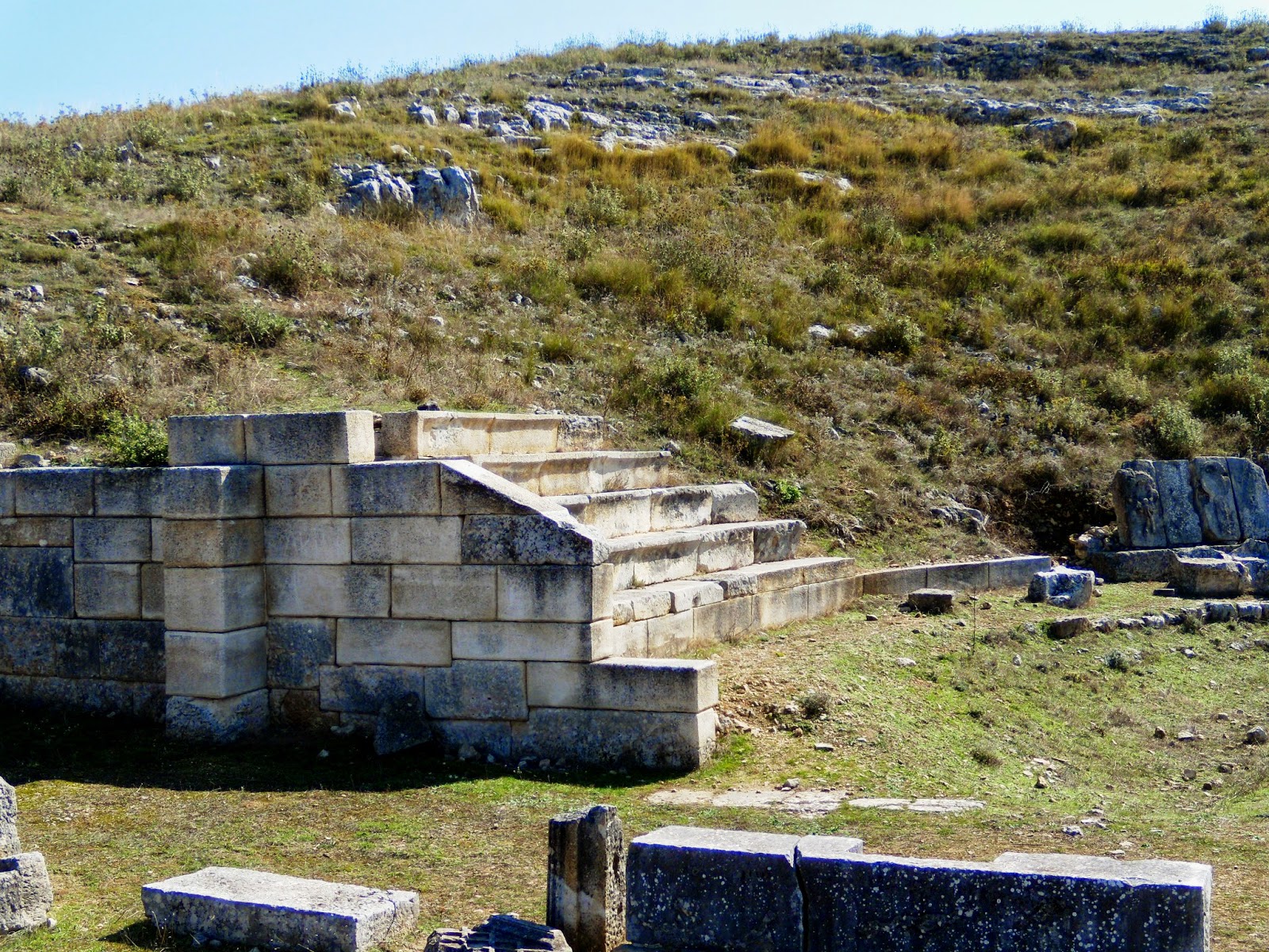
The best-known site is the sanctuary of Dodona, which King Pyrrhus of Epirus promoted as the religious capital in 290 AD. It features a remarkable theater and is seen as the oldest Hellenic oracle. Other notable places are Gitana (3rd century BC), Amvracia (founded in the 7th century BC. It was given to Pyrrhus by the son of Cassander in 294 BC); Cassope (founded in the 4th century BC), and Nicopolis (founded in 28 BC by Octavian after his victory at Actium). 

At present, a project has been conceived to link the theaters of these towns together and to create a brand new tourist trail. The idea behind this plan is that from antiquity onward, theaters are places where people met and interacted on different levels. 

These five archaeological sites are stringed along a circuit of 344 kilometers which the intrepid traveler can discover. Although the theater shares a common link, it is obvious that the sites have much more to offer when it comes to archaeology, history, culture, art, and modern daily life. 

The article from the Archaeology News Network puts the accent on developing tourism in the region. Still, the underlying historical value of the antique cities is not in the least described. Without their appropriate background, it is difficult to truly appreciate the theaters as their focal points.

Friday, May 15, 2015

Revealing Byllis in ancient Illyria

Before my trip to Albania in search of Illyrian remains (see: A closer look at Illyria), I had never heard of Byllis, for even on the internet, the information is pretty scant and vague. Yet the site of Byllis is one of those where you feel at home and where every ruin is exactly as it should be – a very strange awareness!

The location of Byllis has nothing to envy any antique city and certainly not any Greek or Roman city situated at the border between Illyria and Epirus. Had I studied the life and conquests of Pyrrhus of Epirus more closely (which I’ll do pretty soon), I would inevitably have come to this remarkable city, but at this stage, it is a blank page. The origins of Byllis are still obscure, but according to one theory, it may well have been founded by this very King Pyrrhus, who is still held in high esteem today. Another theory, confirmed by numismatics, pretends, however, that the city was built by Myrmidons returning from the Trojan War.

Byllis is perched high on top of a hill, some 520 meters above sea level, overlooking the Vjosa River and definitely occupying a strong strategic position. The city is surrounded by sturdy Hellenistic walls over a distance of more than two kilometers, 3.5 meters thick, and reaching a height of eight to nine meters; it is interrupted by six fortified entrance gates. No less than four inscriptions testify to the reconstruction by the Byzantine engineer Victorinus, who worked upon instructions of Emperor Justinian (end of 5th-early 6th century AD).  Enough of this wall has survived to underscore the sense of security the inhabitants must have felt. To me, it looks like an eagle’s nest overlooking and commanding the entire valley below.

It is, however, very difficult to label Byllis as Illyrian since the vehicular language was Greek (although most people were bilingual) and all the institutions, officials, fortifications, and city planning were clearly Greek also. The ancient road to Apollonia ran right through Byllis, connecting the city with Macedonia at one end and with Antigonea in Epirus on the other side. Buildings like the stadium and theater, for instance, are pure Hellenistic.

I first walk through so-called storage rooms, but it is unclear why they were built here and who could profit from this storage area. Huge earthen jars and pots, now in shards, remind me of Minoan pottery and were definitely well-secured by the maze of thick-walled rooms.

Pretty soon, I arrive at the recognizable Forum – no doubt built on top of the Hellenistic Agora - surrounded by an L-shaped Stoa, two stories high. The earliest agora has been dated to the second quarter of the 3rd century BC, and the 11.4 meters-wide Stoa ran over a total length of 144 meters: the eastern wing (partially cut out of the rock) was 37 meters long and the southern wing 73 meters. The supporting columns were of Doric order, with hexagonal columns on the ground floor, while Ionic columns on the upper floor supported the roof. The set-up of this Stoa is inspired by the one at Apollonia (see: Along the Via Egnatia: Apollonia). Later, the Byzantines built their basilicas inside and in between these remains, meaning that one has to be alert when looking at stones and walls, but the typical Byzantine crosses on column capitals and altar slabs are very helpful.

Comfortably nestled against the hillside, most of the theater has survived, although it has been used as a quarry by the Byzantines.  The original Greek theater was built in the middle of the 3rd century BC and counted 40 tiers, providing seating for as many as 7,500 spectators, which, based on the size of Byllis, means that visitors from neighboring towns attended the performances. It is said to resemble the theater of Dodona in neighboring Epirus, but I am not in a position to compare. Clearly, this theater has been “updated” by the Romans, who added the skena of which only the foundations remain. A corner of the seating area has been reconstructed to give a better feel of the building, and it is interesting to look around for the many details of decorations for the walls, seats, and the trimmings of the skena. I find it striking that the VIP seats are still present around the orchestra in Greek fashion, meaning that this theater was never adapted to be used for animal fights, as the Romans generally loved to organize. The view from up here is, as always, breathtaking!

Turning away from the steep edge on which the theater stands, are the remains of the arsenal, also from the 3rd century BC, and reconstructed during the 1st century AD using the so-called opus reticulatum technique (square diamond-shaped tufa blocks positioned with their corners downwards). It lies about three meters below the adjacent prytaneion (sacred meeting place) and measures 18.2x6.2 meters. This prytaneion, dedicated to Artemis, in turn, is 20 meters long by 6 meters wide and may well be one of the earliest buildings in the Agora.

Byllis also had a stadium from the end of the third century BC, one of the strangest constructions I have ever seen. Only one side of this stadium has been preserved. From the original length of 190 meters, the bottom seating stairs have survived over 134 meters. Near the theater, we can find as many as 19 steps still in place, but overall, there are no more than three or four. But what makes this track so unique is that it runs alongside a huge public water cistern of 51 meters and 4.2 meters wide. This means that this vaulted cistern with a capacity of about 1,200 m3 was constructed underneath the stadium itself. The water was collected from the roofs of the Stoa and from the stairs on the south side of the stadium. In Byzantine times, Emperor Justinian built his baths right next to this cistern, and the facilities were used till around 550 AD.

Remarkably, some remains of private houses have been excavated as well, both Hellenistic and Roman, which I think is rather unusual. Hellenistic houses are rare, and I’m glad to find a clear layout for one of them. It dates from the third century BC and measures 30m x 25m. It is built around a central courtyard of approximately 10m x 10m surrounded by colonnades behind which we find the various rooms; typically, it had its own well (see also: Olynthus and its houses).

All in all, I find it strange that neither here at Byllis nor at any of the other ancient cities in the area (Apollonia, Brundisium, Buthrotum, Dyrrhachium) so little remains from the Macedonian occupation of Alexander and his father, Philip II, before him. Obviously, neither king was there to build a city as their only purpose was to submit the Illyrians as a whole, but since it was the Greeks who colonized this region in the first place, it is awkward to find only sporadic remains of that period – unless the Romans have thoroughly destroyed the buildings that existed previously in those settlements.

[Click here to see all pictures of Byllis]

Saturday, April 11, 2015

The surprise of Butrint, ancient Buthrotum in Epirus

Under Roman rule, the Via Egnatia strategically connected Byzantium via Thessaloniki to Rome thanks to the crossing of the Adriatic Sea between Dyrrhachium and Brundisium. But there was another lesser road that led south to the city of Buthrotum, modern Butrint, right across from Saranda, one of the newest bay resorts in Albania.


Yet Buthrotum was not born with the Romans but like most towns in the area, it was founded by colonists from Corinth and Corfu at some time during the 7th or 6th century BC – although according to the legend its founder was a son of King Priam of Troy, which is a more noble ancestry, of course. To me, this is Epirus, the homeland of Queen Olympias, Alexander’s mother and it is not surprising that in her days the city was important enough to have a sanctuary dedicated to Asclepius with its own theatre and agora; besides, it was protected by a city-wall with five entrance gates.

For some reason, I always thought that all of Epirus was part of modern Greece, but it seems that this ancient country has been split up between Greece to the south and Albania to the north. All I knew about it was the oracle of Dodona, so it is a surprise to hear that Buthrotum was important before the arrival of the Romans. The main attraction may well have been the sanctuary of Asclepius, which was built on a series of terraces rising from a paved area in front of the theatre. The reconstruction as shown on the billboard at the entrance of the site is very clear, but it is much harder to find pre-Roman evidence on the site itself. The sanctuary included a temple, a stoa, and a treasury, all modified by the 3rd century BC to include a theatre and a building that may have served as a hotel for the pilgrims.

As early as 228 BC, Buthrotum became a Roman protectorate, and its influence spread steadily till the city was included in the province of Macedonia. Julius Caesar thought it was an appropriate place to settle his veterans after fighting Pompey in 44 BC, but a wealthy local landlord, Titus Pomponius Atticus, objected to these plans and went so far as to plead his case at the Roman Senate through his friend, the orator Cicero. He was successful, and only a small number of settlers were relocated to Buthrotum. They blended in pretty easily with the locals, and their presence left a definite Roman stamp on the city.


It seems appropriate to take a closer look at Titus Pomponius Atticus, one of the richest men of his time. He lived in Athens for almost twenty years (hence the name Atticus) and showed great interest in Greek culture and philosophy. He bought an estate near Buthrotum and probably acquired more land in neighboring Epirus and Corfu. Although his villa is explicitly mentioned in his correspondence with Cicero, it has not yet been found, but it is generally accepted so far that it was situated in the river valley, where cool breezes soften the heat of summer. Atticus’ wealth, which he acquired as a financier and by managing his land properties, gave him great influence in politics as we have seen above. He was a gifted politician who managed to remain on good terms with both parties involved, the Romans and the locals. He died in 32 BC, aged 78, shortly before the Battle of Actium. Five years earlier, he gave his daughter Caecilia in marriage to Agrippa, Augustus friend and general. Consequently, Atticus’ influence continued after his death through his son-in-law.

In 31 BC, Emperor Augustus conceived plans similar to those of Caesar for after his victory over Marc Anthony and Cleopatra at Actium (some 200 km south of Butrint), he considered Buthrotum to settle his veterans. Once again, the new arrivals, though limited in number, blended in well, and the city expanded rapidly, doubling in size even. At this stage, Buthrotum required a major building plan, which was funded by Augustus in person as well as by his family or private parties. The main projects were the construction of a new aqueduct to feed the many fountains and bathhouses, and a bridge across the Vivari Channel. At this stage, the city appears as Colonia Augusta Buthrotum. Most of what we see today at Butrint may date from Augustus reign since statues of the emperor and of his wife Livia have been found – a sure sign of the city’s loyalty and support.

As in any excavation site, the theatre is what we see first. Although the earliest construction goes back to the 4th century BC, when it was part of the Sanctuary of Asclepius, it was clearly rebuilt and enlarged during the 2nd century AD to become the Roman centerpiece of the city. Today, the lower part of the theater, mainly the stage, is flooded by groundwater, adding a romantic touch with its reflection in the pool. Unique are the many manumission inscriptions that have survived on the outside walls of the theater, dating from shortly after 232 BC. The freeing of slaves, which seems to have lasted for sixty years, was accomplished in the name of a god, generally Asclepius, hence the close link between the theater and its inscribed walls with the treasury of which close to nothing remains.

Behind the cavea of the theater are the remains of the Roman Baths, which are also flooded. Part of the hypocaust is being preserved, exposing some of the fire-resistant bricks used in the floor heating – always an exciting element, I’d say.

The Forum is located next to the theater and the Baths, and originally was located at the heart of the Hellenistic city. In those early days, i.e., late 2nd/1st century BC, it measured a modest 4.5 x 25 meters. Towards the 2nd century AD, the area was enlarged to the size we see today, 52 x 20 meters, but most of it still remains buried.

Further down the island, around the corner of the abovementioned buildings, are the remains of a rather imposing Nymphaeum that must have lined up with the Roman aqueduct that ran across the Vivari Channel and the valley floor to the hills from where the water was transported. Thanks to one of the billboards, I am able to locate the header tank of this aqueduct on the other side of this channel. The spring itself has not been located with certainty, but it seems to be found near Çuka e Aitoit (Eagle Mountain), a rough 12 km away. This fountain, once enhanced with statues of Dionysus and Apollo, appears to lean against the city wall, basically built in the 6th century AD but mixed with remains of earlier Roman constructions. The access to the Vivari Channel, however, was preserved as there are several entrance gates in this wall, still easily recognizable. Today, it is a very peaceful water channel where time seems to have come to a standstill. It is not certain, but this aqueduct may well have served as the first bridge across the channel, and as such, adding to Buthrotum’s status since the city was now connected with the wider Roman world. Aqueducts were very costly enterprises, and only rich cities or those sponsored by private patronage could afford them. Great cities like Athens or Corinth, for instance, didn’t have any aqueducts till the rule of Emperor Hadrian! That definitely proves how wealthy and how important Buthrotum was in its heyday!

This is also the area once occupied by the Gymnasium, but which in Byzantine times was filled by the Great Basilica and its dependencies. It is here that we find a Baptistery from the 6th century AD with an exquisite mosaic floor, covered for its own protection, which is unfortunate for us visitors. It consists of seven circular bands around the baptismal font, thus creating the figure eight, the Christian number for salvation and eternity, I am told (although I have not encountered this explanation before). The mosaics show animals (representing land), birds (representing air), and fish (representing water), in accordance once again with early Christian symbols of salvation. The entrance is flanked by two mosaics of large peacocks (symbolizing paradise and immortality) with a vine growing out of a vase (symbol for the blood of Christ).  Apparently, the roof of this Baptistery was supported by two circular rows of columns, of which only the bases remain. It is worthwhile to mention that this is the second-largest Baptistery in the Eastern Roman Empire after the Aya Sophia in Istanbul.


From the 3rd century onward, Buthrotum started to decline, and a severe earthquake destroyed large parts of the city. It shrank, and a new, smaller city wall was needed. The relief of the so-called Lion Gate on the road to Epirus, which was added in the 5th century to reduce the size of the gate, is a clear illustration. Even an untrained eye can see how this wall has been altered time and again, with steps leading nowhere and dead-end tunnels. When Buthrotum became the seat of a bishop in the 6th century, the Baptistery and Basilicas mentioned above were built, and at the same time, the city walls were reinforced.

But like its neighbors, it was attacked and sacked by the Huns. Over the following centuries, Butrint was occupied in turn by several foreign forces till it turned into a malaria-infested swamp.

The very top of today’s Butrint is crowned by a castle that was reconstructed over the ancient acropolis and now serves as a museum that badly needs some improvement or modernization, unfortunately. It houses finds from Butrint itself but also from other nearby sites, showing some pieces from the Hellenistic occupation but mostly from the prosperous Roman period.

Today, a flat barge ferries men and cars across the Channel to the Vrina plain on the other side. In Roman times, that was the location of a thriving suburb of Buthrotum where the rich and famous had their vast residences. It is here that archaeologists are looking for the remains of Titus Pomponius Atticus’ estate. Work in progress …

Monday, January 26, 2015

What if … Alexander had lived a few more years to conquer western Mediterranean?

That is another ball game altogether. Alexander definitely had drawn his plans as contained in his notebooks (hypomnemata). He had already started exploring the coastline of the Arabian peninsula, an expedition cut short because the peninsula turned out to be far larger than expected. His ships went as far as the Strait of Hormuz without knowing they had reached the headland that Nearchus had seen when sailing up from India into the Persian Gulf in 324 BC.

The projects were grand, far beyond the visions of any of Alexander’s successors, and are best documented by Diodorus and Curtius. Instructions had been given to build a thousand warships, triremes up to septiremes in Syria, Phoenicia, Cilicia, and Cyprus to be eventually sailed into Babylon’s harbor. They would serve in a campaign along the coast of North Africa to conquer the strong Carthaginian realm. Interestingly he planned to build a road along the coast of Libya, as North Africa was named in his days, running all the way to the Pillars of Hercules, i.e., modern Gibraltar. Knowing that the first coastal road through today’s Libya was built by Mussolini in 1937 clearly, shows how daring a project this was. The conquest of the coastal regions, which would also include Iberia (Spain) and Sicily, evidently implied establishing a series of ports and dockyards where the ships could forage on provisions and get repairs done. Curtius even goes so far as to mention that Alexander’s plan was to reach the Alps and return to Epirus via the seacoast of Italy.

Alexander’s visions were not limited to warfare only; they included the arts as well. Six expensive temples were to be built, each costing 1,500 talents, located at Delos, Delphiand Dodona; one at Dion in his homeland and dedicated to Zeus; one at Amphipolis for Artemis Tauropolus; and finally, a temple in honor of Athena at Cyrnus (modern Corsica). Second to none, a particular temple dedicated to Athena should be constructed at Ilium (Troy) also. To remember his father, Philip II, he intended to erect a tomb as great as the largest pyramid in EgyptDinocrates of Rhodes, who had already worked for Alexander in planning the city of Alexandria in Egypt, reconstructing the Temple of Artemis in Ephesus, and assembling the massive funeral pyre for Hephaistion, had also drawn plans to carve an immense image of Alexander in the flank of Mount Athos in Greece’s Chalcidice – a plan that may or may not have been taken into account by the king.

These plans prove Alexander’s determination and do not leave room for failure. He would conquer the entire Mediterranean, something the Romans achieved only several centuries later. Still, their empire was not the making of one man and did not take shape in one lifetime. The Greek language, for centuries the lingua franca all over the Middle East, including today’s Iraq, Iran, and Afghanistan, and helping to spread Christianity, would also be spoken and used in our western countries; Latin may not have had a chance beyond a local nucleus. Our world definitely would have looked very different, considering that the knowledge of Greek philosophers, mathematicians, artists, and sailors would have flowed straight through our veins!

Unfortunately, when Perdiccas found these orders after Alexander’s death, he decided that the expenses were far too high. Diodorus mentions that even the Macedonians, when these plans were read out aloud, realized that the projects were excessive and impractical. Well, I would say this is only one way to present the case since there certainly was no shortage of money to sponsor the Successors’ wars for forty years! But, on the other hand, if things had evolved differently with Hephaistion or Craterus at the helm in Babylon instead of Perdiccas, who knows what could have happened to Alexander’s dreams.