Alexandria's founded by Alexander

Alexandria's founded by Alexander the Great (by year BC): 334 Alexandria in Troia (Turkey) - 333 Alexandria at Issus/Alexandrette (Iskenderun, Turkey) - 332 Alexandria of Caria/by the Latmos (Alinda, Turkey) - 331 Alexandria Mygdoniae - 331 Alexandria (Egypt) - 330 Alexandria Ariana (Herat, Afghanistan) - 330 Alexandria of the Prophthasia/in Dragiana/Phrada (Farah, Afghanistan) - 330 Alexandria in Arachosia (Kandahar, Afghanistan) - 330 Alexandria in the Caucasus (Begram, Afghanistan) - 329 Alexandria of the Paropanisades (Ghazni, Afghanistan) - 329 Alexandria Eschate or Ultima (Khodjend, Tajikistan) - 329 Alexandria on the Oxus (Termez, Afghanistan) - 328 Alexandria in Margiana (Merv, Turkmenistan) - 326 Alexandria Nicaea (on the Hydaspes, India) - 326 Alexandria Bucephala (on the Hydaspes, India) - 325 Alexandria Sogdia - 325 Alexandria Oreitide - 325 Alexandria in Opiene / Alexandria on the Indus (confluence of Indus & Acesines, India) - 325 Alexandria Rambacia (Bela, Pakistan) - 325 Alexandria Xylinepolis (Patala, India) - 325 Alexandria in Carminia (Gulashkird, Iran) - 324 Alexandria-on-the-Tigris/Antiochia-in-Susiana/Charax (Spasinou Charax on the Tigris, Iraq) - ?Alexandria of Carmahle? (Kahnu)
Showing posts with label Kyzylkum. Show all posts

Thursday, May 19, 2022

Weather conditions during Alexander’s march East

As I so often stated, the weather conditions are not important for historians. We find only a few examples in Alexander's campaigns, like the Monsoon in India and the flash flood in the Gedrosian Desert. Still, in reality, the weather did play a vital role in his campaign in the East.

Throughout their march from Greece to India, the Macedonians must have been plagued by recurrent earthquakes that disrupted their advance or their camp. Alexander could sacrifice to the gods, but he could not prevent or control these natural disasters. 

Speaking to one of the locals in Turkey, I remember him pointing out that he preferred to be “in the open” rather than inside any building when an earthquake occurred. Being outside, he would witness boulders rolling downhill and trees being shaken, but none of the rattlings would be as frightening as when sitting inside a house or shack.

It is easy to imagine how, in Alexander’s campsites, the army tents would collapse, banging up the occupants. Frightened horses and pack animals would try to run if they were not adequately secured by their attendants. When an earthquake hit the troops on the march, they could immediately react accordingly.

Another natural threat is the wind, which may not sound so dangerous, but the situation could be life-threatening when it creates a storm.

This idea occurred to me during my trip to Iran when I skirted the Zagros Mountains. In the winter of 330 BC, Alexander marched south using approximately the same route I was following a little later in the year, i.e., in April (see: The Zagros Mountains and the Persian Gates in Alexander’s footsteps).

I was plagued by a severe sandstorm that blew relentlessly during my three-day journey. Visibility was very low as the sands from the Mesopotamian Valley in modern Iraq were carried through the air. My clothes flapped around me as if they were to be torn away any moment, while the sand was stinging my face and hurting my body. The wind whistled through the lunch place, and the sand battered against the windows.

Inevitably, my mind drifted back to Alexander as he must have known days like this. Traveling in the comfort of my air-conditioned vehicle was hard enough. However, when I stepped outside of this protective shell, I had a taste of what he experienced – if not here, certainly in other locations.

Curtius seems to be the only one to write about Alexander’s expeditions into the interior of Persia some time in Spring 330 BC, where he was troubled by heavy rain and “almost intolerable weather.” He even was stopped by heavy snow that had frozen solid; not for long, though, as he immediately started making his way, breaking the ice with a mattock, an example that his men promptly followed (see: Alexander amidst the pomp and circumstance of Persepolis).

While we take bad weather as a mere inconvenience, we cannot underestimate its far-reaching impact. That became clear after reading The Road to Oxiana by Robert Byron. Byron traveled to Iran and Afghanistan in 1933, using whatever means of transportation available. The weather conditions commanded his advance to a degree I did not expect. The Macedonian army must have faced similar conditions that hampered their progress to the same extent.

Byron is hit by what he calls a burning dust-storm, a good one hundred miles east of Hamadan, ancient Ecbatana. Near Bisutun, he witnessed great spirals of dust, “dancing like demons over the desert,” stopping his car and choking the passengers. 

Wind, rain, and ice are Byron’s main challenges. He attempted to drive south from Tehran to Isfahan in early February but was stopped some ten miles out. The road turned into a sheet of ice that partly thawed and had frozen again. The scene must have been spectacular, for he writes, “At this moment the sun rose, a twinkle of fire lit the snowy plain, the white range of the Elbruz was suffused with blue and gold.” A beautiful picture, but a horrible travel condition.

A few days later, it rained for twenty-four hours. Byron was still stopped in Tehran by a “deluge of rain” in the last days of April. As he traveled further East via Damghan to Mashed, a route that approximately matches Alexander’s, “the rain fell like a bath-waste. For miles at a time the road was a river, the desert a flood, and every mountain a cataract.” The roads turned into fast-flowing rivers.

In Spring, Byron eventually reached Herat and continued due East to Kunduz. On his road to Balkh, where Alexander made camp and wintered in 328 BC (see: A view of the Karakum and Kyzylkum Deserts and Afrasiab, ancient Samarkand), Byron describes how “the rain came down in sheets. … every angle of the mountains was occupied by a cataract. … along that narrow ledge whence the red pinnacles rose into the clouds above, and whole ranges could be seen emerging from the clouds below…” A little further, he continues by saying that “the color of the landscape changed from lead to aluminum… The clumps of green trees, the fountain-shaped tufts of coarse cutting grass, stood out almost black against this mortal tint”.

Mazar-i-Sharif fared much better in the last days of May. He described how the clouds gathered on the mountains each afternoon, although summer should have set in six weeks before. People said they had never witnessed such conditions. The weather one hundred years ago was as unpredictable as today. The rain that fell before Byron’s arrival in the city was enough to close the road to Kabul for a whole month! An entire village had fallen down in a nearby gorge. Just picture Alexander having to cope with such extremes!

After Kunduz, Byron turned West, following the river of the same name to the plain of Bamyan, crossing the stream nine or ten times over wooden bridges. I doubt these bridges existed in Alexander’s days when the army had to find a way through the water. In June, Byron heard that a landslide had blocked the other side of the Shibar Pass. In fact, “heaps of liquid mud and pebbles concealing large rocks.” The travel conditions became increasingly drastic. “The crops below the road, already half destroyed by the rivers of mud, were now menaced by a further spate.”

Alexander probably took this same road in the fall of 327 BC when he left Bactria for India by the Shibar Pass (see: Alexander crosses the Hindu Kusha second time). Nobody mentions any landslides occurring, but they were undoubtedly recurrent because further down Byron’s road to Kabul, another dozen landslides prevented him from reaching the city. Was Alexander just lucky and under the protection of the gods, one wonders?
The crossings of the Hindu Kush, in turn, have been pictured very well by Steven Pressfield in his book The Afghan Campaign. He describes the pure horror and misery the army endured in their daily lives of survival (see: From Afghanistan into Bactria across the Hindu Kush). Arrian, of course, gives us the facts, but Pressfield, with his skills as a military writer, adds the human experience to the expedition.

Picking up Byron again, we read how on the road from Kabul to Ghazni – which Alexander traveled in the opposite direction to cross the Hindu Kush into Bactria – “two lorries were completely wrecked by the stream … the Kunduz ferry has overturned and sunk, drowning five women.”

Reading our history books, we are far from realizing that traveling or leading an army was a dangerous enterprise. Not only because of the enemies that had to be subdued but also because of the terrain and the weather conditions, which, as I said above, were seldom mentioned or recorded.

Monday, March 19, 2012

A view of the Karakum and Kyzylkum Deserts (Central Asia 2)

[1 - Alexander marched his army from Bactra (Balkh in today’s Afghanistan) with heavy losses through the Karakum Desert to reach the Oxus River in pursuit of traitor Bessus, who proclaimed himself king after killing Persian King Darius III]

In the early morning I’m being directed to board the plane that will take me from Tashkent in eastern Uzbekistan to Urgench, approximately 300 km south of the Aral Sea and squeezed halfway between the Oxus River and the border of Turkmenistan – in fact nearly at the end of the Uzbek world.

My bi-plane is not very reassuring and looks very much like a fixed-up engine coated with successive layers of paint to cover up the presumed crust of rust underneath. I hesitate to climb on board and even ask the welcoming stewards if this plane is truly safe. Well, they are not going to deny that – after all, they will be taking off with me. I am crowded in with another twenty brave travelers. Inshallah!

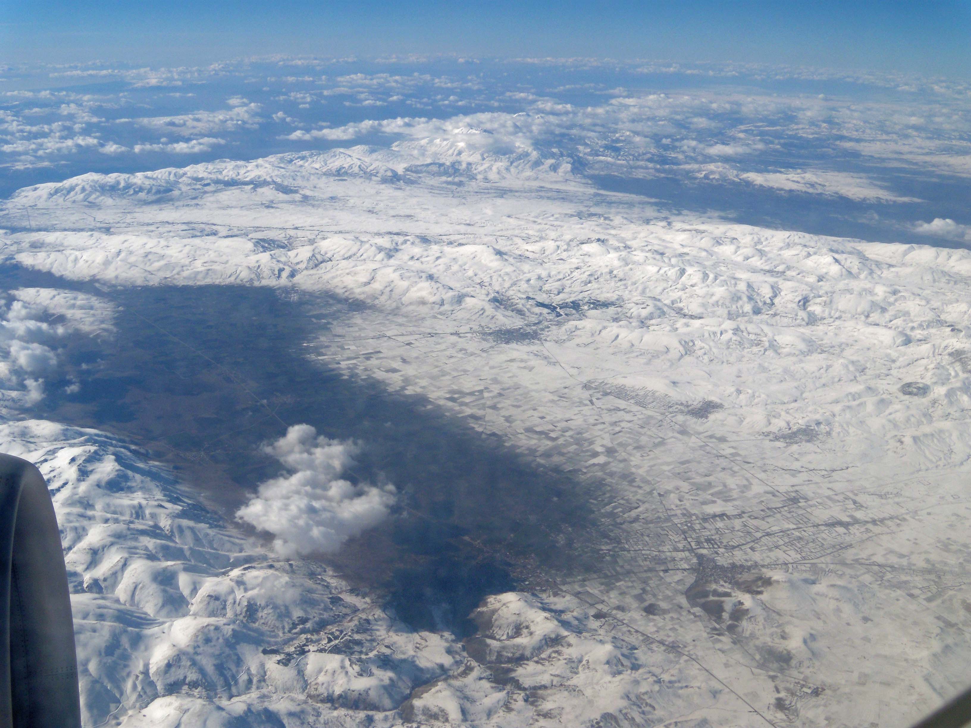
Instead of the promised one hour flight, this plane takes double that time but once I have accepted that my destiny was in the hands of Zeus, Zoroaster, and Mohammed, I am starting to enjoy my ride. This being such a small plane, it has the advantage of flying at a lower altitude so that I can follow its route across the landscape below. It is like reading a map at life-size scale! The Kyzylkum, meaning Red Desert soon shows its monotonous terrain and my thoughts almost immediately drift back to Alexander the Great and his army crossing similar stretches of desert.

As so often, he has my deepest respect. Watching these endless sandy hills enhanced with rare green dots of long grasses and entirely stripped of trees, I can only have admiration for Alexander’s courage and determination when he covered the fifty miles of “pebbled desert” to reach the banks of the Oxus River after he left Bactra in the spring of 329 BC. He and his army faced unbearable heat among shifting sand dunes where daytime temperatures easily ran above the 40 degrees centigrade. There was a dramatic shortage of water and in an unforgiving attempt to quench their thirst, the soldiers in their despair broke into the provisions of wine and oil, which made things only worse. It is said that when Alexander reached the Oxus he ordered to light huge bonfires to signal his men in the right direction. Survivors went back with water to help their comrades, others simply died on the spot after drinking too much of the tempting river water. We do not know how many men Alexander lost during this journey but rumors have it that the figures ran higher than the losses he suffered during any of his battles. That should tell us a lot.

With the map on my knees, I follow the patchy desert as it unfolds under me, wondering how different this Kyzylkum can be from the Karakum on the south side of the Oxus River which Alexander crossed. I decide it has to be minimal – a different color, a different texture with more pebbles and maybe a little less “green”, but as barren and hostile as what I see here. From time to time there is a tiny lake or some marshlands but clearly not enough water for anyone to settle in the area for I see no constructions and no roads, except the straight line of the main road which I’ll take later on and which connects Nukus-Urgench to Bukhara, Samarkand and Tashkent beyond.

At last, the landscape turns green with square irrigated fields and narrow shiny canals turning increasingly larger as my plane sets in its descent. Water definitely makes the whole difference. Rows of whitish houses and high-rise buildings appear in straight lines and squares among the lush green lands till a wide meandering river appears. I’m sure this must be the Oxus flowing in lazy curves dotted with sandbanks and flanked by the fertile green parcels, cotton no doubt. Such a wide river, which Alexander has crossed on more than one occasion. I feel at least as excited about this view as when I first saw the Euphrates River. If only those rivers could speak…!

My rickety plane lands without any problem and I continue my trip by bus to Khiva, a true treasure filled with Tamerlane’s legacy which is another story altogether.

[Click here to see all the pictures of the desert]
Click here to read Episode 3 of  Central Asia