Alexandria's founded by Alexander

Alexandria's founded by Alexander the Great (by year BC): 334 Alexandria in Troia (Turkey) - 333 Alexandria at Issus/Alexandrette (Iskenderun, Turkey) - 332 Alexandria of Caria/by the Latmos (Alinda, Turkey) - 331 Alexandria Mygdoniae - 331 Alexandria (Egypt) - 330 Alexandria Ariana (Herat, Afghanistan) - 330 Alexandria of the Prophthasia/in Dragiana/Phrada (Farah, Afghanistan) - 330 Alexandria in Arachosia (Kandahar, Afghanistan) - 330 Alexandria in the Caucasus (Begram, Afghanistan) - 329 Alexandria of the Paropanisades (Ghazni, Afghanistan) - 329 Alexandria Eschate or Ultima (Khodjend, Tajikistan) - 329 Alexandria on the Oxus (Termez, Afghanistan) - 328 Alexandria in Margiana (Merv, Turkmenistan) - 326 Alexandria Nicaea (on the Hydaspes, India) - 326 Alexandria Bucephala (on the Hydaspes, India) - 325 Alexandria Sogdia - 325 Alexandria Oreitide - 325 Alexandria in Opiene / Alexandria on the Indus (confluence of Indus & Acesines, India) - 325 Alexandria Rambacia (Bela, Pakistan) - 325 Alexandria Xylinepolis (Patala, India) - 325 Alexandria in Carminia (Gulashkird, Iran) - 324 Alexandria-on-the-Tigris/Antiochia-in-Susiana/Charax (Spasinou Charax on the Tigris, Iraq) - ?Alexandria of Carmahle? (Kahnu)
Showing posts with label Priene. Show all posts

Tuesday, September 24, 2024

Reading and decoding inscriptions

Today’s visitors will inevitably come across many inscriptions when visiting ancient sites or museums. Reading Greek or Latin is not for everybody, and understanding the meaning of the text and context is reserved only for the happy few. The stone or marble support has more often than not suffered from wear and tear, leaving the untrained eye to merely guess its value. 

We are lucky to find an explanation next to the inscription, rarely a full translation, as those are reserved for scholars. Well, the text may be boring, but it also may contain some exciting twists and turns. Yet, who wants to know? 

In antiquity, people would read the latest laws and decrees, regulations and agreements, peace treaties, manumission of slaves, grave markers, boundary stones, milestones, etc., as they walked through public spaces. Some of these texts are still in situ, particularly those engraved on the walls of still-standing monuments. The majority, however, has found a place in the museum for safekeeping and is often out of sight. 

The most familiar examples of inscriptions are those chiseled on grave steles, sarcophagi, and tombs. They also appear on the pedestals of statues lining the streets, like Phaselis Harbor Street or Olympia’s road to the Stadium. Others serve to identify the deities, kings, and emperors that fill the sanctuaries and agoras, or the niches of theatres, stadiums, libraries, baths, Nymphaeums, and other public buildings. 

But some inscriptions will surprise many of us. 

For instance, this stele at the Louvre Museum holds the accounts of the Parthenon Treasury. The text covers both sides of the stele made of Pentelikon marble and illustrates how democracy works. Athens magistrates submitted the public accounts to the citizens for all to see. The front side, beneath a relief of the Sacred Olive Tree flanked by Athena and the people (demos), displays the expenses for military operations, religious ceremonies, and the Panathenaic festival held in honor of their patron goddess for 410-409 BC. The reverse side has the expenditures for 407-406 BC.

In Butrint, Albania, a striking series of inscriptions is carved on the outside walls of the Roman Theater of Buthrotum, as the city was called in antiquity. 
They are hard to read but worth our attention because these are manumissions, slaves who had gained their freedom for whatever reason. Their sheer number is mind-blowing!


As surprising and revealing are the Edicts on prices! Who would have thought that there were strict rules to define the prices of goods in antiquity! 
The first such example I encountered was at Ptolemais in Libya, proclaimed by Emperor Diocletian in 301 AD.

Also by Diocletian is the Edict on maximum prices for products and labor discovered in Halicarnassus, dated to 301 AD. The Emperor hoped to stave off a financial crisis and prevent inflation. 

Although this tablet was unearthed in Bodrum (the modern name for Halicarnassus), bits of similar Edicts were also found in Pergamon, Aizanoi, Aphrodisias, and Stratonikea. It is quite surprising to read that the Edict from Halicarnassus consists of 37 parts. Part 9, for instance, is about shoes and boots … 27 different kinds and sizes are listed!

Taxes are another matter that deserves attention. One such inscription that is hard to miss can be seen on Curetes Street in Ephesos, close to the Library. 
This tax law was written in the second half of the 4th century AD, during the rule of Emperors Valentian I, Valensand Gratian.

Less obvious is Alexander’s tax remission from the wall of the Temple of Athena in Priene, now exhibited in the British Museum in London
Alexander contributed to the cost of building the unfinished temple, and in return, he was allowed to dedicate it: “King Alexander dedicated the temple of Athena Polias”. 
This text was followed by a longer inscription setting out the terms of an agreement between Alexander and Priene under which the city was to be exempt from taxation. 

Not all inscriptions were written in Greek or Latin, and I find it fascinating to hunt for these exceptions. 

Having a closer look at Lycia’s sarcophagi strewn throughout the landscape, I discovered texts that seemed to be written in Greek but are in Lycian, as they contain several odd letters that do not exist in the Greek alphabet. Antiphellos and Limyra have good illustrations of Lycian texts.

Another case is to be found in Sillyumsome 25 kilometers northeast of Antalya, an often overlooked site, although the hillside is easily spotted in the otherwise flat plain of Pamphylia. 
It takes some detective work to locate the inscription in the Pamphylian language carved in the doorpost of a Hellenistic building – a very rewarding effort though!

The people of ancient Side also had a language of their own. A small inscription has survived and can be seen at the local museum located inside the remains of the Roman Baths.


After Alexander conquered Lycia and Pamphylia, Greek became the lingua franca, and the local tongues disappeared.

Wednesday, July 26, 2023

A Colosseum in Mastaura, Turkey

The ancient city of Mastaura is unknown to me and the internet is not proving to be very helpful. The site is situated 50 kilometers east of Aydin, Turkey. 

In the middle of nowhere, aerial pictures revealed a circle around a depression that was too perfect to be natural. The untrained eye may miss it altogether but the hidden contours belonged to a Colosseum. A lot of vegetation and a thick layer of soil has hidden this Roman construction from view for centuries. It was discovered in 2020 and as the archaeologists started clearing the site by cutting trees and bushes that had held the stone remains in their grip, they realized it belonged to Mastaura. 

[Picture from Arkeonews]

Having lain buried for centuries, the Colosseum underground is rather well-preserved. The parts of the building above ground reveal rows of seats, the central area where the spectacles took place, and the outside supporting walls and vaults. It is definitely smaller than its counterpart in Rome. 

The amphitheater could soon be dated to about 200 AD, i.e., the days when emperors of the Severan Dynasty ruled, 193-235 AD. 

Usually, amphitheaters are oval-shaped, but this is one of the rare circular examples, measuring 30x40 meters. The only round example I have ever seen was in Cyrene, modern Libya. There, its life started as a theater but the expansion of the city called for an amphitheater. Lacking the space for an oval shape, the builders simply mirrored the existing theater to create a round amphitheater (see: Cyrene, founded by the Greeks). 

The Colosseum of Mastaura offered seating to 15,000-20,000 people, which may have come from neighboring cities such as Aphrodisias, Miletus, Priene, and Ephesos. It is one of three such arenas discovered so far in Turkey. The spectacles were similar to the gladiator battles and animal fights organized all over the Roman Empire. 

Mastaura appears to be built inside a narrow valley, maybe along a small river and covered an amazing surface of 160,000 m2. Over the past two years, researchers unearthed an impressive underground sewage system that spread over the entire city. Based on the engineering technique and the materials used, it can be dated to around 200 BC and was probably used well into the days of Roman imperial rule. The size of the sewer is such that one can comfortably walk inside them. For now, the passage is blocked some 20 meters into the system because the walls caved in. 

[Picture from Arkeonews/IHA]

A lot of work remains to be done at Mastaura, like reinforcing some sections of the walls and brickwork of the Colosseum, clearing the sewage system, and exposing more buildings and artifacts around the city.

Mastaura was important enough to mint its own coins in Roman times, and a substantial number has been found so far and needs to be further analyzed.

Wednesday, July 12, 2023

Does age matter?

Writing about Alexander over the years, I have been handling chronological dates for his whereabouts in the correct time frame. There is, however, another approach to consider and that is Alexander’s age. 

We know he became king at the age of twenty and started his invasion of Asia at the age of twenty-two. He died a month short of his 33rd birthday. All his marches, sieges, battles, and fighting are condensed within this last period of roughly ten years. 

A comparison with any modern monarchy is impossible because there are hardly any kings left and they no longer go to war at the head of their army. To compare Alexander with young men his age today is out of the question also simply because life and the circumstances of living are too far apart. 

Alexander has been taught by Aristotle but again this kind of education cannot be identified with the teaching of a young man in our modern world. I believe that even Philip, although he intended to do what was best for his son, underestimated the vastness of Aristotle’s knowledge. Alexander was meant to rise above Philip because he understood how to draw from Aristotle’s vast database (to use modern terminology) and merge it expertly with his innate infallible instinct - his genius. 

However, Philip may well have realized the potential of his 16-year-old son when he entrusted him with the seal of Macedonia while campaigning against Byzantium. The young prince honored his assignment as Regent by successfully putting down the Maedi revolt on the country’s northern border. 

Two years later, Philip put his son in command of his cavalry at the Battle of Chaironeia. Alexander did more than his share and annihilated the entire Theban Band, all three hundred of them! 

We don’t know how much time the young prince spent among the soldiers growing up in Pella, but I think it is safe to assume it was a lot. Leading the small contingent against the Maedi and the cavalry in Chaironeia speaks volumes. An army has that instinctive flair to recognize a true leader, one they can and will trust. 

This trust would only grow when Alexander became king after his father was murdered. In the next two years, he successfully led his troops against the Illyrians and the Thracians to secure his northern borders, sacked the city of Thebes in retribution for its betrayal, and confirmed his position as Hegemon of Greece as per the Treaty of Corinth. Alexander could never have contemplated his campaign in Asia without the full trust and commitment of his army. 

He crossed the Hellespont shortly before his 22nd birthday and fought the Persian army for the first time at the Granicus River. Later that summer, he marched to Sardes and took Ephesos, Priene, Miletus, Didyma, and Halicarnassus. Alexander spent the following winter in Lycia, after which he conquered Phaselis and Perge. 

When he was 23 years old, he headed north to Sagalassos and from there to Gordion, where he cut the knot. Crossing Cappadocia, he returned to the shores of the Mediterranean. At Tarsus, he fell sick with a fever, which incapacitated him for several weeks. By the end of the year, he was engaged in the Battle of Issus, his first personal confrontation with King Darius. 


In two years, Alexander fought two major battles (see: The Battle of the Granicus and The Battle of Issus, where Alexander and Darius faced each other for the first time), besieged two cities, Miletus and Halicarnassus, and occupied all the major ports in Asia Minor. In our modern world, this means that he crossed all of Turkey. 

At the age of 24, he laid siege to two more cities, Tyre (building a mole in the process) and Gaza. His reception in Egypt was that of a liberator, and he was soon acclaimed as their new Pharaoh - a title that automatically made him a god in the eyes of the Egyptians. At the western end of the Nile Delta, he founded his first Alexandria, a city that still exists and prospers today! 

Many more sieges and battles were to follow in Central Asia and India. We almost take them for granted, despite that every siege and every battle came with its own technicalities and challenges. Alexander faced many hardships as he traveled through deserts, waded through countless rivers, and crossed mountains as high as those of the Hindu Kush! 

The three years Alexander spent in Sogdiana and Bactria, from his 27th to his 30th birthday, were an uninterrupted succession of skirmishes and fights in guerrilla wars he was totally unfamiliar with. The events culminated with his victory at the Battle of the Hydaspes against the Indian King Porus. By then, he and his men had covered some 28,000 kilometers, creating many new Alexandrias in the process. 

Although Alexander is usually depicted sitting on his horse, we have to keep in mind that he moved at the pace of his foot soldiers. Riding bareback was not comfortable, not for the rider and not for the horse (see: No saddles and no stirrups for Alexander’s cavalry). 

It is impossible to imagine anyone covering such a distance on foot. It would imply walking an average of 2,800 kilometers a year, ten years in a row! Let us keep in mind that many of his troops were veterans of his father’s days, men in their fifties, sixties, and even seventies! Not a leisurely trip for the fainthearted. 

Speaking of walking: how many pairs of shoes, boots, and sandals would the Macedonians have worn out? Providing new ones for some 40,000 men or more would have implied production on an industrial scale! Maybe we should believe the sources suggesting that the soldiers fought and walked sections of the route barefoot?

Sadly, Alexander died far too young, and so did Hephaistion, but men like Ptolemy and Seleucos lived to the ages of 84 and 77, respectively. Age clearly is not everything!

Thursday, November 18, 2021

Herakleia-by-Latmos

Herakleia-by-Latmos is one of those odd places to visit. The remains of the ancient city are squeezed between the Latmos Mountains and the edge of Lake Bafa. However, you have to find them! 

Today’s village of Kapıkırı holds few promises of interesting ruins as its houses are built on top of the ancient remains. It takes a careful eye to spot abandoned walls, towers, column drums rooted into a tree, and other heart-shaped drums among the modern constructions. 

To start with, the place is off the beaten path and hard to find. That was not always the case because, in antiquity, Herakleia had full access to the sea deep inside a vast gulf. Over the centuries, this gulf has mainly been silted up with the alluvia carried along by the Meander River. By the end of the 3rd century AD, access from the sea was cut off, and all that remained was Lake Bafa. 

When Alexander the Great besieged Miletus, he and his army arriving from Priene had to march along the shores of this vast Latmian Gulf. Now, looking south from Priene towards Miletus, we’ll notice a flat plain that was once at the bottom of the sea. 

It is generally admitted that Herakleia was founded by Pleistarchus, son of Antipater (see: Antipater and Alexander), in the early 3rd century BC. He ruled over large parts of Caria and made Herakleia his capital, initially named after him, Pleistarcheia. 

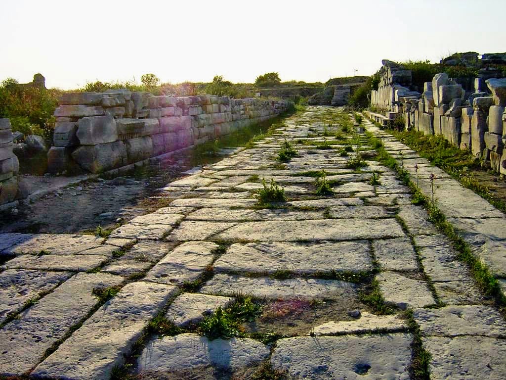
Pleistarcheia/Herakleia prospered in Hellenistic times as goods arriving by sea from the west were forwarded further by road into the Carian hinterland. An extensive network of roads, probably conceived by Pleistarchus exiting the city, has been discovered. It is not easy to piece the remaining sections together because, over the centuries, its stones have been reused elsewhere. As the pavement shows no ruts from carts and is occasionally interrupted by stairs, these roads were only used by pedestrians, horses, and beasts of burden. They connected, however, with essential thoroughfares in the valley of the Meander. 

Archaeologists eventually bring the scattered remains to life by recognizing the constructions from antiquity. The open space of the Agora is easiest to spot by the modern visitor as it functions as a parking lot. The marketplace measured an impressive 60x110m and was surrounded by marble colonnades in the Doric style. This was the center for commerce and trade of cattle, agricultural products, and honey in particular. 

Overlooking the Agora are the walls of a temple built in the Doric order with two, now missing, columns at the entrance. It was most probably dedicated to Athena. Inscriptions on the outside walls of the temple reveal that it served as an archive to the city. They also give us essential information about the history of Herakleia and Asia Minor in the early 2nd century BC. In those days, the ambition of the Seleucid king Antioch III was to rule over all of Asia Minor. However, the Romans defeated him at the Battle of Magnesia ad Sipylum in 190 BC. The blocks with these inscriptions are scattered on the temple's north side. From the south side, another inscription was recovered that is being kept at the Louvre. This is a letter by Lucius Cornelius Scipio, Consul of Rome, and Publius Scipio, his brother, addressed to the Boulé and the people of Herakleia. 

Also dating from the 2nd century BC are the Bouleuterion, the theater, and the Gymnasium. There are, of course, many other remains from temples and houses that need further investigation. From later dates are the Roman Baths, a Nymphaeum, as well as remains of the city walls. The ramparts are among the best-preserved of their time, extending for more than 6 km and counting over 40 towers. In places, they stand to a height of 6 meters. 

Herakleia’s necropolis is located in the far south of the city, as always outside the walls. A large, not yet excavated tumulus is believed to belong to Pleistarchus. Hundreds, maybe even thousands, of rock-cut graves do not immediately catch the eye as they appear as mere rectangular openings in the rock wall. 

The conclusion is that there is far more to explore and discover than one would expect at first sight! As mentioned in my bibliography, I’ll gladly refer to the beautiful book, although written in German Herakleia in Latmos by A. Peschlow-Bindokat.

Monday, November 12, 2018

Importance of the Meander River (western Turkey)

The River Meander in Asia Minor played an important role in the history of Miletus and Priene because its large alluvial deposits completely changed the landscape. Miletus in particular had four harbors on the Gulf of the Aegean Sea but with time they silted up and even the Island of Lade has been entirely integrated into the flat alluvial plain. (see: Miletus, Alexander’s first siege in Asia). Part of the water body still exists today but is cut off from the Aegean by the deposits and goes by the name of Lake Bafa.

[Picture from Hurriyet Daily News]
The Meander, modern Menderes River, is 550 km long and truly meanders through southwestern Turkey, irrigating farmlands and carrying industrial waste mainly from juice factories.

An alarming article has been published in the Hurryiet Daily News stating that the Meander is the country’s third most polluted river. For many years, experts have warned about this situation and are once again calling for an intervention in order to avoid environmental disasters since human health is in danger as well.

At its source near Dinar, the water is crystal clear and many species of birds and fish thrive but once it enters the province of Uşak where leather is treated on an industrial scale the water changes color, and the smell becomes unbearable the further you go downstream. There is a ban on fishing in these tainted waters and it has been established that some 1.5 million trout have been killed in the process. Entering the village of Balata, the water is as black as coal and smells of rotten animal corpses. At the mouth of the river, fish die by the thousands every week.

It is terribly sad that such a proud river from antiquity has been mistreated by successive civilizations making it unfit not only for agricultural irrigation but mainly for drinking. Fish and birds are dying but the rate of human death is much higher for those living along the river banks. A true disaster for mankind.

Over centuries, the Meander River has been the lifeline on which people could rely and that is no longer the case.

It appears that the Meander is not an isolated case. In another article, the Hurried Daily News reveals that 79% of Turkey’s freshwater bodies are polluted. That is particularly true for the western coast of Turkey (provinces of Muğla and Izmir) and also for Istanbul.

Wednesday, August 12, 2015

A walk through ancient Miletus

Together with Ephesus and Priene, Miletus is one the grandest cities on Turkey’s West coast to visit. Yet, unlike Ephesus with its Curetus Avenue and the superb view of the Library of Celsus, its well-restored villa’s and the splendid theater, Miletus has hardly more that the very impressive theater to offer to the hasty visitor. There is much more, of course, but it takes some time and effort to investigate further and to mentally put the temples, agora, baths and its once so busy harbor in place.


A great way to prepare your next trip is this virtual tour of Miletus. You can choose your own itinerary by using the arrows and zooming in and out. Have fun! 

Friday, July 17, 2015

Priene, a virtual tour

Our imagination is always very much put to the test when visiting an antique site for we have mentally to reconstruct the buildings and the streets with all their trimmings and decorations. In some cities with enough temples and theaters still standing the task is much easier than in the places where we have to work with scant remains.


So, bless the modern technology enabling 3D reconstructions of those ancient places. Today Priene is put in the limelight, offering a superb look at the general layout of this unique Hellenistic city!

Of course, this is not exactly how Alexander experienced Priene, but it is close enough.

Monday, April 6, 2015

Priene, delightfully Greek

Unlike so many remains of Greek settlements, Priene has not been turned into a Roman city. What a delightful blessing!

Priene, like neighboring Miletus and Ephesos, was part of the Ionian League, regrouping twelve city-states that existed already before 1000 BC. Around 450 BC, the city was designed by the same architect as Miletus. His name was Hippodamus, after whom the well-known and most popular Hippodamian plan was named and used all over the Hellenistic world.

Priene was occupied in turns by Athens and Persia, but after the death of King Mausolus in 353 BC the city fell under Athenian rule. It is said that Alexander stayed here in 334 BC while besieging Miletus. It is in Priene that he received the embassy led by Glaucippus, a well-respected citizen of Miletus, who suggested leaving the harbor available to both Persians and Macedonians at will. This did not fit Alexander’s purpose; keeping an important port as Miletus open to the Persians was far too dangerous in his eyes. Alexander must have spent several months in Priene which had willingly surrendered to the Macedonian King for Miletus was a tough nut to crack (see: Miletus, Alexander’s first siege in Asia).

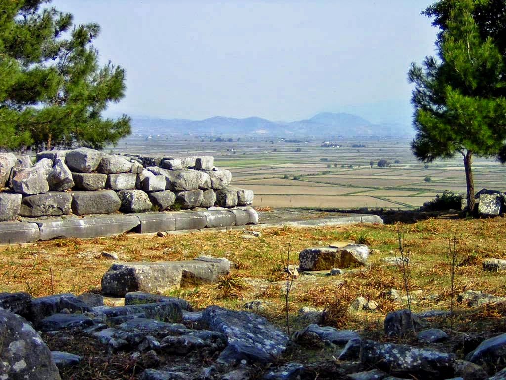
Priene occupies an impressive location and can be spotted from afar. It is nestled against Mycale Mountain, and the location somehow reminds me of Delphi. A steep and stepped road runs upwards to the city walls, two meters wide and six meters high. The spaced freestanding watchtowers are rather exceptional for this meant that they could easily be rebuilt in case of destruction. The rampart and the city gate are what the visitor sees first after a pretty strenuous climb – impressive!

The main road inevitably leads to the Hellenistic theater built at the same time as the city itself seating 5,000 visitors spread over 50 rows and resting against the gentle mountain slope. Five marble VIP seats around the orchestra are still in place and were not removed as usual during Roman modifications. Across from the theater lies the upper Gymnasium from the 4th century BC and several later Byzantine buildings.

Further down the street, one can hardly miss the Temple of Athena with its slender bluish-grey marble Ionian columns pointing to the sky that were reassembled thanks to the many drums lying around. Pytheos, who also was the architect of the famous Mausoleum of Halicarnassus, had just started building this temple when Alexander arrived. As a matter of course, the King immediately financed its construction, and a dedication to that effect, now at the British Museum in London, reads “King Alexander has dedicated this temple to Athena Polias. How unique that this testimony survived the centuries for it makes Alexander’s presence almost palpable. The temple measured 19.55x37.20m and had eleven columns lengthwise and six for its width. An altar of Athena Polias including the relief of a Muse from the 2nd century BC has been unearthed and is now on display at the Pergamon Museum in Berlin.  Pytheos never finished the job and the temple was finally completed by Emperor Augustus who from then onward was worshiped here together with Athena.

In the next city block, we find the remains of a 116-meter-long Sacred Stoa, erected between 130-112 BC. The Stoa’s wooden roof was as so often supported by two rows of columns, Doric on the outside and Ionic on the inside, splitting the more than twelve-meter-wide promenade in two. This Stoa ran parallel with the 75-meter-long Agora that was reached by six steps since the square laid about 1.5 meters lower. One end of the Agora was reserved for the fish and meat market and the other end was occupied by a temple dedicated to Zeus or Asclepius.

Just behind the Sacred Stoa is the Bouleuterion, a square Council Hall seating 640 delegates and the best-preserved building in Priene. The auditorium is surrounded on three sides by rows of benches, 16 on the north side and 10 on either side. In the center of this Bouleuterion from the 2nd century BC, stands an altar decorated with wreaths and bullheads. The original columns supporting the protecting wooden roof are still in place. The adjacent Prytaneum where daily administrative operations were carried out is more difficult to find. The only indication is a stray column with an inscription since this was the Sacred Heart of the City that kept the eternal burning sacred fire.

The street running along the Agora ends at the western city gate and is lined with private houses. It is believed that Alexander lived in one of the houses on the left-hand side, probably because a statue of the conqueror was found there; yet there is no hard proof for this theory, however, tempting it sounds! The statue moreover dates from the 2nd century BC and can be seen at the Altes Museum in Berlin. The house itself, nicely sign-posted, is not different from its neighbors in the street, except maybe for the sacrificial table found in one of the smaller rooms. Moreover, this street is surprisingly Greek with the gutter running on the side of the pavement, very much unlike Roman roads.

During my very first visit, I had not looked into the geographical situation of Priene, and standing here high above the vast flat plain below, I instantly realized that this was an alluvial plain created by a river (in this case the Maeander). This means that in Alexander’s days, all the land below was sea and that in order to reach Miletus he had to make quite a detour, skirting the eastern foothills. Priene itself never had direct access to the sea, and its harbor was the nearby town of Naulochos. How strange to be reading history like this. The islands mentioned by ancient writers are now reduced to mere bumps in the landscape as pointed out by Peter Sommer during my next trip.

After Alexander’s victory over the Persians, Priene like all the other Ionian cities widely prospered. A small testimony of its wealth can be found at the Altes Museum in Berlin where we can admire some splendid statues of Dionysus, Aphrodite, and an unknown young man.

Of course, not much of the city dates from Alexander’s days but it definitely is Hellenistic and not “spoiled” by the Romans. This makes it quite a unique place to take in. So much history has been written in Priene and yet only a few tourists bother to stop here, while the city is so filled with past sounds of the Macedonian army and if you listen carefully, the soft breeze may still carry the name of Alexander.

Thursday, February 12, 2015

Miletus, Alexander’s first siege in Asia

While Alexander was still in Ephesos, the Persian governor of Miletus, Hegisistratus, made his appearance at the court. He came in peace, offering the surrender of the city. At that time, Miletus was the largest Greek city on the eastern shore of the Aegean Sea.

Its origins go back to Mycenaean times in the 11th century BC. In 670 BC, Miletus started colonizing the coast of the Black Sea, the Mediterranean, and the Sea of Marmara. Just like Priene and the other cities belonging to the Ionic League, Miletus suffered from repeated Persian invasions and occupations, the most memorable of which happened when Cyrus defeated Croesus of Lydia, causing the fall of Miletus. In 499 BC, however, this city led the Ionian Revolt against the Persians, punishing Miletus and destroying the mighty city, but it soon recovered.

So, by the time Alexander arrived in 334 BC, Miletus was in Persia's hands only because its excellent harbor was their main base, ideally situated to control the other cities of Asia Minor or launch a counter-attack on mainland Greece. Miletus was surrounded on three sides by the sea and had strong fortifications on the landward side. It is not surprising that Alexander welcomed Hegisistratus’ offer.

In this context, Alexander marched towards Miletus with only a small number of troops in his entourage. Yet, at the same time, news reached Hegisistratus that a 400-warship strong fleet of the Persians was only three days away. This gave the governor new hope and a good reason to resist the Macedonian king, who found the city gates closed upon arrival.

Meanwhile, Alexander’s own fleet of 160 ships commanded by Nicanor (brother of Parmenion) had anchored on the island of Lade, just off Miletus. The island was fortified with 4,000 men 4,000-man-strong garrison ready to make it difficult for the Persians to use the harbor for their operations. Consequently, the Persian fleet was forced to land off Mycale, some 15 km south of Miletus. The situation at sea seemed locked for the time being. Alexander decided to begin besieging Miletus from the land side, confident that the Persians were in no position to help or reinforce the city from the sea.

For the time being, Alexander made himself comfortable in nearby Priene and directed the siege operations from there. Here, he was approached by an unexpected embassy led by Glaucippus, a well-respected citizen of Miletus. His proposal was that Miletus would become a free city, meaning that both Persians and Macedonians could use its harbor at will. If he had accepted, Alexander would have allowed the vital port of Miletus to be open to the Persians, who had access to the entire coast of Asia Minor.

Early next morning, Alexander moved his siege engines forward, probably including his stone-throwing catapults. Artillery was used to chase the defenders from the walls, after which the battering rams and scaling ladders were brought in. The wall crumbled soon enough, and the city was quickly taken. The Greek fleet, which had positioned itself as a ring around the city, successfully prevented the Persians from giving Miletus any assistance.

Panic broke out among the citizens of Miletus, who immediately offered to surrender to Alexander. Alexander probably accepted their plea, but he slaughtered nearly all the Greek mercenaries who had defended the city from the Persians. Only about 300 of these mercenaries escaped, using their shields as makeshift rafts to paddle to safety on one of the many rocky islets off Miletus. Of course, Alexander was not going to leave it at that and mounted scaling ladders to the front of his triremes to be used by his men to land on the islet. On the other hand, the mercenaries did not ask for mercy but were prepared to fight to the death. At this point, Alexander showed clemency, and in the end, they were included in his army.

With Miletus taken, Alexander could now concentrate on eliminating the threat of the Persian fleet. He did not want to get involved in a naval battle because his fleet was much smaller, and the men on board were not trained in maritime warfare. Instead, he sent Philotas by land to Mycale, preventing the Persians from landing and getting new provisions and fresh water from the River Maeander. The fleet withdrew, seeking protection on the island of Samos instead. Eventually, the Persian fleet moved south to the safety of Halicarnassus, which was still in Persian hands.

This being settled, Alexander elected a democratic leader, canceled all taxes, and boosted commerce – in short, he started a new period of prosperity for Miletus. This prosperity ended with the arrival of the Romans in 133 BC, who imposed high taxes now that the city was part of their Provincia Asia. By the third century AD, Miletus’ decline set in as its harbors silted up and marshes were formed.

Today, the antique city is to be found 10 km inland, and in springtime, the once so busy port is covered by extensive marshlands filled with reed and blooming irises. In a way, this helps to imagine what this vast harbor must have looked like. The old rotunda was part of the Harbor Monument built in honor of Pompey in 31 BC, still surrounded by water. This Monument must have been at least 7.5 meters high and may have carried a big iron pot on top, part of which is now on display at the Pergamon Museum in Berlin. Maybe, after all, it was a beacon? Although the marshes are omnipresent in springtime, the land is dry in autumn, meaning that the visitor gets quite a different view of Miletus in either season.

In historical literature, Miletus is described as less impressive than Priene, but I think that is somewhat cliché, for it is just different.

The most striking building is the theater sitting on the hilltop, commanding the entire city of Miletus. It is one of the most splendid constructions one can imagine, not only because of the many tiers of seats that have been so well preserved but also because of the entrance gates and the near-intact vaulted corridors. This theater clearly illustrates the high level of architecture reached by the Romans; the very concept of theater is highly efficient. Easy walking steps take the visitor to the cool entrails with fascinating views over the surrounding landscape and the interior of the theater itself. The first theater was evidently Greek, built in the 4th century BC, and counted approximately 5,300 seats; the Romans extended it in the 2nd century AD to hold 25,000 people. The façade is impressive enough, 140 meters long and 30 meters high. It is hard to imagine this theater's full impact since the upper tiers' stones have been taken to build the Byzantine church on top, leaving a mere seating space for 15,000 people.

From up here, one can easily see the layout of the entire city. Following the marshy water line from the harbor, I find the Delphinium, the open-air Temple of Apollo Delphinius, the protector of the seafarers and the ships. The four remaining columns of the Ionic Stoa next to it quietly reflect their image in the still waters covering the North Agora. Sitting in the shadow of these columns, I discover an ancient graffiti of a fish and the Greek word IΧΘΥΣ, both symbols that were used by early Christians – what a rewarding moment!

The remains of the adjacent Hellenistic Gymnasium are relatively poor, and the colossal Nymphaeum from the 2nd century AD flanking it on the other side requires lots of imagination to picture it. Across from the Nymphaeum are the remains of the Bouleuterion, built between 175 and 164 BC. But here, as elsewhere, the parts belonging to the Hellenistic period blend in very harmoniously with those added later by the Romans.

Further south, past the South Agora, the Baths of Faustina, Marcus Aurelius wife, are visible; rough brick arches and walls don’t do justice to the once so great building whose ornamental statues are now in the Archaeological Museum of Istanbul. These baths date from 43 AD, and I’m not surprised to hear that they served as a role model for the Turkish baths, the hammam. This South Agora, belonging to the 2nd century AD, measures an impressive 196x164 meters and must have been impressive. The southern entrance gate to this Agora has been entirely moved and reconstructed at the Pergamon Museum in Berlin (unfortunately, it was under restoration when I visited the museum).

It certainly is worthwhile to visit Miletus in spring and again in fall when the water level has receded, and the Agoras show their large slabs of marble flooring. At that time, the outline of the different buildings was much more recognizable, which truly helped to get a comprehensive view of the city.


Between the Baths of Faustina and the South Agora lies the Temple of Serapis from the 3rd century AD. Not much is left except the re-erected pediment showing a relief of the god Helios Serapis wearing a crown of sun rays. The rectangular buildings seen on the right-hand side are warehouses.

That brings me to the most exciting location in Miletus, the Sacred Road that led all the way to Didyma, the city renowned for its oracle. The first road dates back to at least the 6th century BC, but it has been improved and embellished over the centuries. In 100 and 101 AD, Emperor Trajan, for instance, raised the road level and made the necessary repairs. From the early days onward, this Sacred Road was lined with statues of the Branchidae (priests and priestesses attached to the temple of Didyma); crouching lions and sphinxes; votive fountains; and even monumental tombs and sarcophagi belonging to important persons. None of these features is to be seen anymore since all were moved to the British Museum in London, the Archaeological Museum in Istanbul, or the local Museum of Miletus. This 16.5-kilometer-long road was entirely paved and had a width of 5 to 7 meters. Both in Miletus and in Didyma, it is still pretty easy to locate a sizable stretch of this Sacred Road; just have a close look. I was so lucky to be put on the right track by Peter Sommer during my travel on his tour "In the Footsteps of Alexander the Great" - a most rewarding experience! 

I have not found any indication about the road used by Alexander on his way from Miletus to Didyma, but it is rather evident that he would have followed this Sacred Road. For me, this is another place where Alexander’s presence is still tangible. 

[Click here for more pictures of Miletus]