Alexandria's founded by Alexander

Alexandria's founded by Alexander the Great (by year BC): 334 Alexandria in Troia (Turkey) - 333 Alexandria at Issus/Alexandrette (Iskenderun, Turkey) - 332 Alexandria of Caria/by the Latmos (Alinda, Turkey) - 331 Alexandria Mygdoniae - 331 Alexandria (Egypt) - 330 Alexandria Ariana (Herat, Afghanistan) - 330 Alexandria of the Prophthasia/in Dragiana/Phrada (Farah, Afghanistan) - 330 Alexandria in Arachosia (Kandahar, Afghanistan) - 330 Alexandria in the Caucasus (Begram, Afghanistan) - 329 Alexandria of the Paropanisades (Ghazni, Afghanistan) - 329 Alexandria Eschate or Ultima (Khodjend, Tajikistan) - 329 Alexandria on the Oxus (Termez, Afghanistan) - 328 Alexandria in Margiana (Merv, Turkmenistan) - 326 Alexandria Nicaea (on the Hydaspes, India) - 326 Alexandria Bucephala (on the Hydaspes, India) - 325 Alexandria Sogdia - 325 Alexandria Oreitide - 325 Alexandria in Opiene / Alexandria on the Indus (confluence of Indus & Acesines, India) - 325 Alexandria Rambacia (Bela, Pakistan) - 325 Alexandria Xylinepolis (Patala, India) - 325 Alexandria in Carminia (Gulashkird, Iran) - 324 Alexandria-on-the-Tigris/Antiochia-in-Susiana/Charax (Spasinou Charax on the Tigris, Iraq) - ?Alexandria of Carmahle? (Kahnu)
Showing posts with label Selge. Show all posts

Monday, October 10, 2016

The Battle of Eurymedon

The Battle of Eurymedon is quite a revelation, for I never heard of it before. I drove along this river on my way from Aspendos to Selge, not knowing that an important fight had taken place here about one hundred years before Alexander marched through this area (see: Selge welcomed Alexander).

After all, my lack of information may not be so surprising as this battle occurred near the end of the Delian League. This was an alliance of various Greek poleis that took shape shortly after the Persian invasion of 480-479 BC and ended at the same time the Peloponnesian War did in 404 BC and which was mainly fought between Athens and Sparta.

The Delian League obviously takes its name from the island of Delos, where the league’s treasury was kept and where the members met on regular set occasions. It is common knowledge that this league was created to take revenge for the Persian invasion of Greece. Still, it also aimed to liberate all the Greeks under Persian domination and guarantee the freedom of the Greek cities.
  

Towards the end of the Delian League, the Athenian statesman Cimon was instrumental in creating Athens’ powerful maritime empire. He was the hero of his time after fighting at the Battle of Salamis. It was a small step to be promoted Admiral and lead the fleet of the Delian League with 300 triremes, of which 200 were Athenian. This was in 466 BC when he set out along the Carian and Lycian coasts to expel the Persian garrisons and to bring those liberated cities into the league.

After taking Phaselishe set sail for the Eurymedon River, today’s Köprülü River, to annihilate the 200 ships' strong Phoenician fleet that had occupied the river together with several reinforcements from Cyprus. This was Cimon’s most famous battle, and his victory here proved to be definitive. In this phase, he seems to be a precursor of Alexander!

It would have been nice to know where exactly this battle took place, although the mouth of the river near Aspendos sounds to be favorite.

Monday, October 28, 2013

Selge welcomed Alexander

Selge is one of those hidden treasures just a stone’s throw north of Antalya that only a few people visit.

The road leads through an inhospitable land with barren hills, rough rocks, and recently burnt-down trees and bushes, to the banks of the Eurymedon River, today’s Köprülü River that flows past Aspendos further downstream. This river lightens up the entire landscape, tracing a pale turquoise ribbon through the young green grasses and the dark pine trees. The repeated rapids in this fast-flowing water make it very suitable for rafting, a booming business, it seems. Nature unfolds in all its splendour and once again I wonder if Alexander had an eye for this kind of beauty. The higher the road climbs, the denser the thick pine trees, creating a dramatic setting against the snow-topped Taurus Mountains reaching to 2,000-2,500 meters. The steel blue sky makes every turn of the road a picture-perfect postcard.

Inside the National Park of Köprülü, named after the Roman bridge that still spans both steep canyon walls of the river by the same name, I have to drive my car over this centuries-old bridge – quite an exciting experience! From this point onward the road takes one hairpin after the other, but the view is breathtaking! The Eurymedon River gets ever smaller and the view ever wider. Shapeless grey rocks of conglomerate curiously dot the soft spring grass with its profusion of flowers. The scene has something dramatic, unreal, but at the same time timeless - a primeval force. Then the first terraces appear, neatly trimmed parcels of cultivated land promising a good harvest. Above them the first houses arise, low constructions providing shelter from the cold and wind, built in the same grey rocks I saw earlier and brightened up with red tiles. This is the village of Altinkaya, actually built among the ruins of antique Selge.

Selge itself is spread over three hills, all three being located on top of the same hilltop. Nobody in his right mind would even think about attacking or besieging such a city! An earthen road winds between somber houses, a desolate place softened up by a few scanty blossoming pear trees. In antiquity, grapes were cultivated in these parts and even olive trees managed to survive the harsh conditions of Selge. Old sources also mention the presence of a small tree that produced a resin similar to that of incense; an occasional rare specimen may have survived. The grapes disappeared with the arrival of Islam and today their living conditions look even more precarious than before.

Strabo tells us that Selge was founded in the aftermath of the Trojan War, during the second millennium BC. After that the Spartans moved in, followed later on by emigrants from Rhodes, but that the true history of the city starts with the arrival of Alexander the Great in 333 BC.

Selge was constantly at odds with its neighbors and that included Termessos which Alexander would besiege afterwards. So the people of Selge thought it wise to welcome the Macedonian King from the start. Later on, the city would do the same with the Romans although they remained independent until the fall of the Roman Empire. In the fourth century, the Byzantine Emperor Theodosius decided to settle the Goths in Phrygia (i.e. the northern region) who, warlike as they were, attacked and destroyed many cities in Anatolia. In 339 AD they also stood before Selge but couldn’t take the city.

Nothing has been excavated here and everything is left the way Selge was abandoned eons ago. Most remains are like elsewhere in Turkey from Roman times, roughly the 2nd century AD. As always, the theater is the eye-catcher. Built in three-quarters of a circle, its plan is typically Greek; the 30 tiers below the diazoma out of the total 40 are still preserved because they rest on a rocky bottom while the upper 15 rows were supported by masonry that collapsed over the years. Close to nothing is left of the Roman scene that was added later on. Just before entering the theater, I luckily noticed the blank panel that never received its inscription. The theater seated 9,000 people, meaning that Selge must have counted 20 to 25,000 inhabitants. It is a mighty sight, to say the least, and the view from the top towards the snow-capped Taurus Mountains is absolutely breathtaking. I could spend all day just sitting here on the top row…

Through a gate holding the chickens, I enter the Stadium. The owner of this parcel, an elderly man, kindly opens and closes his rudimentary gate in the fence made of all sorts of planks and branches wired together. I glance at his house if I may call this a house, four grey stone walls recuperated from antiquity no doubt but properly covered by a modern tile roof. Three months of the year Selge is covered under the snow, so this roof is definitely no luxury. The inside is a black hole with barren stone walls and an earthen floor, one room for everyone and everything. How can they possibly heat such a place? It takes some effort to discern the outlines of the Stadium, half broken down, half overgrown, or disappearing inside some shack. According to George Bean (Turkeys’ Southern Shore) it never reached the full length of 185 meters, which was also the case with the Stadium of Arykanda and several others but I never seem to have paid much attention to the measurements.

The place is totally littered with loose stones, broken columns and pottery, and plenty of antique rubble through and over which one has to find a way to other paths, passing through more wooden gates and climbing over low walls. Yet I reach the Basilica on the second hill and suddenly I'm standing in the middle of the fully paved Agora, measuring approximately 50 x 50 meters. Remains of the Stoa that framed the Agora on three sides await craftsmen to put the columns back in place. I find a stone with a Greek inscription between Corinthian capitals and column drums, and behind that, a row of loose square pillars line up along what might have been a street. Gee, if only archaeologists would come down here and excavate Selge like they did in Arykanda, it looks so promising!

I scramble around for about three hours, visiting only two of the three hills. I take a good look at the third hill from the top of the second one to define the impressive city wall, once three kilometers long. I’m truly baffled for I had no idea that Selge was so large and so imposing. No wonder Alexander left Selge for what it was! In the middle of no man's land, at a height of 2,000 meters, what was the point? Yet this is a majestic landscape.

Returning along other tracks, I pass a spring of clear water in the shelter of a rock wall, in fact, this is the antique spring that is still being used by the villagers who fill their plastic jerrycans here every day as there is no running tap water.  

I leave Selge which looks still as poor as it was in the second half of last century when George Bean visited it, and I cross the same Roman bridge again. This time, I take the time to stop for a closer look into the deep canyon. You have to admire the engineers from antiquity to dare “hang” this bridge so high above the water and in such a way that it still is being used today. The wild waters of the Köprü River are squeezed through the narrows from which two waterfalls add to the spectacle. In fact, these waterfalls are fed by underground springs whose water is pressed through the cracks in the rock formation. I don’t think the rafting companies I passed earlier today will dare venture into this part of the river! A little further down there is a second bridge, the Bügrüm Bridge from Ottoman times that spans the Kocadere River, a tributary to the Köprü (old Eurymedon) River. There is a path leading over that thin arch but that is too daring for me. I also come across the typical red and white marks of the Lycian Way that follows an ancient road that once connected Side to Konya.

Yes, there is enough left for a second visit to Selge, someday soon I hope.

Monday, September 16, 2013

Birds without Wings by Louis de Bernières

From time to time I pick a book from my shelves that is not directly related to Alexander, but may be so indirectly like for instance my travel guides to Turkey.

Alexander is always immediately associated with Greece (or Macedonia for that matter), and rightfully so, but we generally tend to forget what he did and left us in today’s Turkey. The Ionian cities along the west coast were Greek and were conquered by Alexander one after the other: Sardes, Ephesos, Miletus, Priene, Didyma and finally Halicarnassus to name just a few. It was in Turkey that Alexander had his first encounters with the Persian army, at the Granicus to start with and a year later at Issus. We should not forget how he took the Pamphylian cities of Perge, Side, Aspendos, Selge before marching north to Sagalassos and beyond to Gordion – whether or not to cut the famous knot. I don’t want to linger on his marching route through Anatolia but he definitely left his marks on the cities and the daily life of its citizen.
 
Birds without Wings (ISBN 978-0-099-47898-0) is set in an entirely different world, the dwindling Ottoman Empire of the early 1900’s from which ashes arose modern Turkey thanks to the relentless efforts of Mustafa Kemal, Atatürk, i.e. the father of all Turks.
 
There are scholars who figured out that the Pax Romana could not have existed without Alexander crushing down the Bactrians and Sogdians, keeping the steppe people away for centuries; Christianity owes its success to Hellenism; so maybe one day someone may prove that the Ottoman Empire could not have existed without Alexander, who knows.

Whatever my own thoughts may be, Birds without Wings is absolutely worth reading. It starts with the life of ordinary people living in a small village in southwestern Turkey where Muslims and Christians mingle together in their daily life. But soon enough their entire world is turned upside down with the Armenian cause, followed by the first World War in which the Ottomans automatically became the enemy of British and French powers culminating in the bloody and horrible combats at Gallipoli. The Muslims from the village are summoned to become soldiers, the Christians in a later phase to be practically enslaved in compulsory labor, leaving only old men, women and children to tend the fields and to survive. As if they had not suffered enough, this utter misery was followed by the massive people migration in which the Turkish-speaking Greeks of Turkey were exchanged against the Greek-speaking Turks from Greece – the memory of which may still be felt in today’s relations between Greece and Turkey.

In any case, this book is both a captivating story and an excellent history of Turkey, most of which goes unknown to the rest of the world and certainly to the many tourists who visit this country year after year.

Thursday, September 12, 2013

Alexander avoided the siege of Termessos

You have to see Termessos for yourself to fully assess the importance of its strategic location. Still, the place today is not easily accessible as it lies in the middle of the National Park of Güllük Dagi, which contributes widely to the sense of walking on trails of eons past.

When Alexander was about to wrap up his campaign in Pamphylia after a short while in Perge, he inquired about the best route towards Sagalassos in the north on his way to Gordion, where he was to meet up with Parmenion and the remaining part of the army.  Some uncooperative guides had advised Alexander to take the route through the narrows of Termessos, a nearly impregnable obstacle. Luckily, the people of Selge were kind enough to draw Alexander's attention to another much easier road, meaning there was no need to besiege the strongly defended Termessos

According to Strabo, the people of Termessos called themselves Slymi, a Pisidian population who took their name from Solymeus, an Anatolian deity. Before Alexander's arrival, very little was known about them, and after his death, the city was ruled quite quickly by the Ptolemies. By the second century BC, ties of friendship were established by Attalus II, King of Pergamon, and the two-story high Stoa was built in his honor. These ties probably led to Termessos choosing the side of Rome and consequently was declared an independent city in 71 BC – a long-lived freedom. Termessos was granted several privileges, contributing to its prosperity. The decline gradually came when it fell under the Byzantine Emperors. The city was finally destroyed by a severe earthquake, ending in its abandonment around the end of the fourth/beginning of the fifth century AD. 

Only a little has been excavated in Termessos, which contributes to its charm, although that does not make the visit any easier; on the contrary, it is quite adventurous. The paths are not very obvious and not without danger, especially in rainy weather. My Sunflower Guide warns the intrepid visitor to move cautiously under such circumstances, so I didn't venture inside alone this time. I was lucky to have visited the site during my Alexander tour with Peter Sommer a few years ago, and that has left a deep impression.

It was very early spring when I followed my fellow travelers among the lush bushes and grasses on the narrow trail. I had no idea what to expect and found it quite exciting to discover remains of city walls and grey spots in the thick, bright green undergrowth. I passed crumbling remains of the Roman Baths next to the Gymnasium and vaulted niches where once the shops lined up around the marketplace. The layout of the Temple of Zeus is hard to picture, but its two-storied walls are impressive enough. 

And then I reach the spot I have been waiting for, the gate through which Alexander was expected to enter Termessos. What a view! On a clear day, one can see as far as Antalya and the Mediterranean. It shows how strong the city's position must have been in this narrow, and they could clearly see their enemies approaching from afar. I can picture Alexander facing this siege; he certainly was not afraid. What a task that would have been! 

The following fascinating spot is, as always, the theater, originally a Greek construction that the Romans adapted to their standards. I marvel at its location, count the five gates on the stage, and chuckle at the sight of the windows in the back wall meant to let the wind through and alleviate the pressure on that wall – how ingenious! It is said that this theater can only be compared to that of Taormina in Sicily, although the Termessos theater is relatively small, seating only 4200 spectators. 

My scramble continues. At times, I have to climb on all fours over the huge building blocks, but it adds to the respect we owe to ancient architects and builders. Between the tree tops, I catch a glimpse of the Temple of Artemis (3rd century BC), walking past the back wall of the Bouleuterion, nearly ten meters high; a Heroon for an unknown hero; till I reach the comfortable Roman pavement leading to the central Agora, once the beating heart of the city where grain and fruit, as well as horses and cattle, were bought or exchanged. Another surprise awaits me here, for this is the first time I see huge 10-meter-deep water cisterns hidden underneath the pavement (it later appears to be a common practice to store water in mountainous areas). But this is quite an ingenious idea, solving the space problem in this terrain or during sieges. The Greeks who occupied Termessos before the Romans had their own cisterns in other locations, and I find one just alongside the trail I am following.

There are more remains of buildings to be found, like this one labeled as Corinthian Temple and Stoa of Attalus, two stories high, just like the Temple of Zeus I saw earlier. The Corinthian Temple takes its name from the Corinthian capitals on the outside columns. It measured some 10 x 10 meters with walls over a meter thick, making it the largest temple of Termessos

The site could be made more attractive to the tourists when so many of the walls are still standing, but then it would also lose part of its charm, which is to discover the buildings on your own as if you were the only one to have found them!

The very climax, however, is the Tomb of Alcetas. I was totally unprepared to see it and didn't even know who Alcetas was then. Meanwhile, I have updated my information.

Alcetas, the brother of Perdiccas, is first mentioned as one of Alexander's generals in his Indian campaign by Arrian. After Alexander's death and during the Wars of the Diadochi,  Alcetas was outlawed after murdering the Macedonian Meleandros, and he found refuge in Termessos. The city promised him protection against his Macedonian rival, 
Antigonus Monophthalmus. But then Antigonus showed up in front of the city with an army of 40,000 infantry, 7,000 cavalry, and numerous elephants, demanding the surrender of Alcetas. The city elders wanted to accept the request, but the young men were ready to fight. To settle the internal conflict, the elders used a ruse (promising to continue the fight) and lured the youth out of the city, so Antigonus could walk in – something Alexander had not been able to achieve.


Realizing the betrayal, Alcetas committed suicide. Antigonus Monophthalmos, as a matter of course, refused to bury him. In the end, the young men, by now filled with remorse and shame, buried poor Alcetas with full honors. Over the centuries, the front of the tomb has vanished, but the back wall still survives to this day, and this is what I am confronted with, without any preparation about the history of the picture. Well, this is quite a shock, for it is like looking at Alexander in person! The mounted warrior is dressed in a complete Macedonian outfit, holding his arm up with what may have been a sword or a spear. There is a striking resemblance between this armor and the one Alexander wore in the famous Pompeii mosaic. Unfortunately, the face has been disfigured, so no eyes are looking back at me. On the next wall, I can discern the body of an eagle with a snake in its beak, symbols of kingship. Some niches once held the burial gifts and remains of a carved-out jar for wine, grain, etc. The Macedonian shield, only recognizable around the edges, has been blasted away, but a grave stele still stands in relief against the side wall. Wow! This leaves me speechless …

Tuesday, May 14, 2013

Pamphylia, generally the area around Antalya

Even in antiquity, the borders of Pamphylia were difficult to establish accurately. It roughly starts in the west, where Lycia stops and covers the plains north and east of Antalya up to the foothills of the Taurus Mountains. The cities in my field of interest generally lie within its borders: Antalya, Perge, Sillyum, Aspendos, and Side, while Termessos and Selge belong to Pisidia, situated to the north, together with Sagalassos.

In as much as it was traceable, the Pamphylian language is a Greek dialect spoken in southern Greece, moving to Asia Minor with its emigrants who arrived here before 1100 BC. Proof of this dialect can be found in an inscription from Sillyum. On the other hand, strangely enough, the people of Side spoke a dialect of their own that had yet to be deciphered.

The history of Pamphylia is somewhat confusing. We have to wait till the 6th century BC when King Croesus of Lydia annexed this territory. However, his rule was short-lived because, in 546 BC, he was already defeated by the Persian
King Cyrus. During the following centuries, Pamphylia was occupied in turns by the Athenians and the Persians until, in 386 BC, a treaty of peace was finally signed by both powers, giving the cities of Asia Minor to the Great Persian King. The yoke of Persian rule was not heavy, and Pamphylia settled quickly.

The situation changed in 333 BC when Alexander entered Pamphylia from Phaselis in Lycia after his march along the coast. His first stop was Perge (Antalya did not exist yet), where he received a delegation from Aspendos, who surrendered their city, provided Alexander did not leave a garrison behind. Alexander generously agrees, but in exchange, he demands fifty talents to pay his army and deliver as many horses as they usually give to the Persian King.

Aspendos accepts, and Alexander moves on to Side, where he meets no resistance. He leaves a garrison behind and returns westwards to Sillyum, which turns out to be the first Pamphylian city to resist. Whoever has ever seen Sillyum (modern Sillyon) will quickly realize that the town is a practically impregnable fortress high on a trapezoidal hilltop in the middle of the plain. As can be expected, Alexander attacks, without success, though. Before he can conceive a second plan, the news reaches him that the people of Aspendos have changed their minds and have decided not to respect the freshly signed treaty. Catapults are dismantled, and Alexander wasted no time marching his army immediately back to Aspendos. This fast reaction was not what Aspendos anticipated, and their previous promises were hastily reconfirmed. Alexander was not keen to start a siege of the strongly defended city. So he agreed, claiming, however, an extra fifty talents, several hostages, and a yearly contribution to be paid to Macedonia. No joking!

Alexander then returned to Perge and conceived plans to push northwards to meet up with his general Parmenion and the rest of his army, which had spent the winter in Gordion. For unclear reasons, Alexander is made to believe that the only road to Gordion passes through the strategic city of Termessos, which commanded a very narrow mountain pass, a sort of Thermopylae. While Alexander was preparing for the attack, a peace delegation from Selge reached him. What exactly has been said remains a mystery. Still, they pointed out that there was indeed a much easier road north, the one that corresponds to the modern main road from Antalya to Sagalassos. The entire attack of Termessos was called off, of course, and Alexander led his army to Sagalassos.
 
After Alexander died in 323 BC, his generals fought and bickered over the territory of Pamphylia, which fell successively under the rule of Greece and Macedonia, then of Egypt under the Ptolemys, and finally under the Seleucids of Syria. By 280 BC, the Seleucid branch of Pergamon was taking over with kings who all went by the name of Attalus or Eumenes. The Romans appear but are in no mood to worry about this part of the world and leave things in the hands of Pergamon. This dynasty ended in 133 BC when Attalus III, the last king of Pergamon, simply donated his kingdom to Rome. But Rome showed little or no interest until they were forced to interfere because of the heavy piracy along the coast of Asia Minor. Solving this problem was not easy. The first success was booked by Servilius Vatia in 78 BC, but Emperor Pompey finalized the job in 67 BC. 


During the days of the Roman Empire, Pamphylian cities received more freedom, especially Aspendos, Perge, Sillyum, and Side. In the year 43 AD, the region was once more joined to Lycia and remained so until the fourth century. The Byzantine Emperors organized and reorganized Asia Minor over and over until Lycia and Pamphylia became once again independent provinces. Later on, it was the turn of the Arabs to take possession of Pamphylia, followed by the Crusaders, until finally, it was absorbed by the Ottoman Empire.  

This is a corner of Turkey I want to investigate further since it plays a significant part in Alexander's conquests eastwards. Walking in the great man's footsteps always is an honor and a privilege, and I'm very excited to see all these fascinating places with my own eyes. Besides the usual Alexander historians, I am relying on the precision work of George Bean with his Turkey's Southern Coast and on the handy maps and itineraries from the Sunflower Guide, From Antalya to Demre.   Alexander, here I come!

[Click here to see all the pictures of Pamphylia]

Monday, March 18, 2013

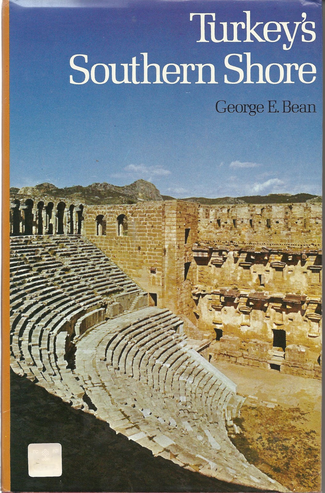
Turkey’s Southern Shore by George Bean

"Turkey’s Southern Shore" (ISBN 0 510 03202 8) is simply the best and most complete book one can find about the larger Antalya area in Turkey, in spite of the fact that information about accessibility and state of the excavations may be outdated since George Bean died in 1977.

George Bean is a legend in this country where everybody seems to know him, has met him or their parents, relatives, neighbors have. He was a broad shouldered man of almost six foot tall and that alone was enough to impress whoever saw him. But apparently he had a most pleasant character and unlike today’s hurried archaeologists, he would simply make his way to the local coffee-house for a chat with the villagers about their daily business, the harvest and their way of living. Slowly winning their confidence, he then would bring up his interest in archaeology with surprising results.

He definitely loved this country and his deep interest for its past transpires through every line. It is surprising to discover how much history, facts and figures he manages to cramp in the story of each town he describes while at the same time he keeps things simple enough to make it passionate reading. Clear drawings, often just a few lines, illustrate his vivid tales and the book is further enhanced with a handful black-and-white pictures. No bombastic language that only an initiate can decipher, but plain words and sentences we all can understand.

In this book, George Bean mainly covers Pamphylia in southern Turkey, but also Pisidia with cities like Termessos and Selge, and Lycia with Phaselis and Olympos. When exploring Pamphylia on my own, it was a true pleasure to talk to locals about this book I carried under my arm. It was as if I were presenting George Bean’s business card for time and again I received a most warm welcome and appreciative words towards this esteemed author. Unbelievable!

Beside his “Turkey’s Southern Shore”, George Bean wrote another three books, “Aegean Turkey”, “Lycian Turkey”, and “Turkey Beyond the Maeander”. You may have a hard time finding any of them though; best chance is a second hand acquisition. Each and every one of these books is a precious tool and an unequaled jewel very much worth the effort looking for.