Alexandria's founded by Alexander

Alexandria's founded by Alexander the Great (by year BC): 334 Alexandria in Troia (Turkey) - 333 Alexandria at Issus/Alexandrette (Iskenderun, Turkey) - 332 Alexandria of Caria/by the Latmos (Alinda, Turkey) - 331 Alexandria Mygdoniae - 331 Alexandria (Egypt) - 330 Alexandria Ariana (Herat, Afghanistan) - 330 Alexandria of the Prophthasia/in Dragiana/Phrada (Farah, Afghanistan) - 330 Alexandria in Arachosia (Kandahar, Afghanistan) - 330 Alexandria in the Caucasus (Begram, Afghanistan) - 329 Alexandria of the Paropanisades (Ghazni, Afghanistan) - 329 Alexandria Eschate or Ultima (Khodjend, Tajikistan) - 329 Alexandria on the Oxus (Termez, Afghanistan) - 328 Alexandria in Margiana (Merv, Turkmenistan) - 326 Alexandria Nicaea (on the Hydaspes, India) - 326 Alexandria Bucephala (on the Hydaspes, India) - 325 Alexandria Sogdia - 325 Alexandria Oreitide - 325 Alexandria in Opiene / Alexandria on the Indus (confluence of Indus & Acesines, India) - 325 Alexandria Rambacia (Bela, Pakistan) - 325 Alexandria Xylinepolis (Patala, India) - 325 Alexandria in Carminia (Gulashkird, Iran) - 324 Alexandria-on-the-Tigris/Antiochia-in-Susiana/Charax (Spasinou Charax on the Tigris, Iraq) - ?Alexandria of Carmahle? (Kahnu)
Showing posts with label Olympos (TK). Show all posts

Saturday, February 20, 2021

Oenoanda in the heartland of Lycia

Oenoanda or Oinoanda lies only some 60 kilometers from Fethiye, right next to the modern village of İncealiler. It is one of those untouched sites, clearly off the beaten path of which there are many in Turkey. Such places are always very rewarding to be discovered and to be explored. It is so remote that even a seasoned archaeologist like Cevdet Bayburtluoglu strongly recommends not to venture there by yourself but to take a caretaker or a villager with you to be safe from sheepdogs. These dogs are fiercely defending and protecting the flock of sheep and goats they are supposed to guard and they readily attack any intruder. No kidding!

The climb up from İncealiler to Oenoanda takes about an hour over rough terrain. It seems that, apart from a few days in 1997, the Turkish authorities never allowed the city to be excavated. Yet, that does not make the site less exciting because one can discover it as we walk on.
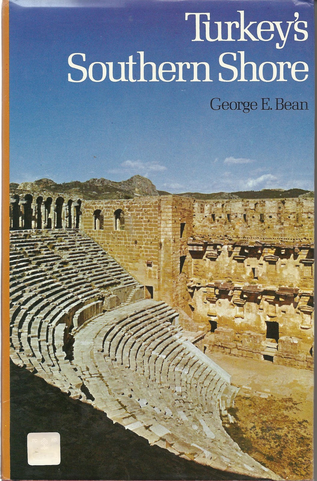
[Picture: Ansgar BovetCC BY-SA 3.0, via Wikimedia Commons]

The most striking feature in the landscape is, as always, the theater that sits higher up the hill overlooking the valley below and offers a dramatic view of the Taurus Mountains. It has been cut out of the rock and its plan closely resembles that of Myra or Phaselis, for instance.

Inside the city walls, of which many stretches are easily spotted, we find the remains of the ancient city. Unfortunately, these have not been properly documented and only the most striking features catch the eye.

A well-recognizable avenue leads from the theater to the Agora. It has been compared to Harbor Street at Phaselis as it is bordered by two steps on either side. The Agora, which is entirely paved with marble, is another prominent feature. The surrounding buildings have not been identified although we may presume based on the broken columns and stones that there was at least one temple erected alongside as is customary. A series of three distinct arches has been identified as belonging to a Library.

Otherwise, bits of columns, capitals, architraves, cornices, pedestals and stones of all sizes with or without inscriptions are scattered around in great numbers. Another recognizable element in the rubble is the broken pipes and remains of an aqueduct that must have run all the way to the Baths in the northeastern corner of Oenoanda.

The origins of Oenoanda are rather obscure but based on its name which contains the letters “-nd” the foundation could go back as far as the 2nd millennium BC. In any case, it has been documented that Oenoanda was part of a tetrapolis annexed to Lycia. Together with KibyraOenoanda became part of the Lycian League which was formed in the early 2nd century BC and they acquired two votes each. The six main cities: Xanthos, Pinara, Tlos, Patara, Myra, and Olympos were the administrative, judicial, military, financial, and religious centers and each received three votes in the meetings of the League.

Pending serious excavations, no evidence has been found about the pre-Hellenistic Era of Oenoanda.

The city gained importance it seems, after the severe earthquake of 144 AD, when they received 10,000 denarii from Opramoas of Rhodiapolis (see: Opramoas of Rhodiapolis) to construct a Bath. It may sound strange because its own citizen, Licinius Langus of Oenoanda donated 10,000 denarii to Myra in order to rebuild their theater and its portico. He could have invested in the reconstruction of his home tome in the first place, no?

Another famous citizen of Oenoanda was the wealthy philosopher Diogenes, who spent his entire fortune on an Epicurean inscription. He had found peace of mind in the teachings of Epicurus and in order to show the people in Oenoanda the road to happiness, he commissioned an inscription 80 meters long and more than 3 meters high which set out Epicurean doctrines in about 25,000 words.  The huge inscription was placed in the agora and its large inscribed letters were painted - nobody could miss seeing them. At that time, in 120 AD, it would have been the largest ancient inscription ever found. The text included a number of instructions, letters, and epitomes defining the basic principles of Epicuraeism. In other words, a guide to happiness.

Unfortunately, the wall disappeared. It may have been deliberately destroyed or hit by an earthquake, but the scattered blocks were mostly reused as building material elsewhere. The wall with whatever remained of Oenoanda fell into oblivion, probably during the 9th century AD.

During the 19th and 20th centuries, many fragments of this precious inscription were found, analyzed and partially put back together like a giant puzzle. That is a gigantic task that is still ongoing.

Oenoanda is surrounded by necropolises on all sides. Rock graves typically appear on both the east and west sides of the city and from the road between İncealiler and Oenoanda many sarcophagi, mostly of the Lycian type, are easily spotted in the landscape.

Tuesday, August 1, 2017

Andriake’s Museum has opened

The opening of this museum in Andriake inside the walls of Hadrian’s Granary (131 AD) has been announced a while ago (see: Time to revisit Andriake, the harbor of Myra) and is now a fact.

It has been baptized as The Lycian Civilizations Museum as it not only contains local finds from Myra and Andriake but from the entire region of Lycia, roughly situated at the southern coast of Turkey between Fethiye and Finike. Except for the coastal cities, Lycia has been very little explored but offers a great number of sites that flourished when they joined hands in the Lycian League founded in the early days of the 2nd century BC. The League had a Parliament of its own, the first ever in history, that was located at Patara. This kind of government may well have inspired modern democracy.

More than one thousand artifacts excavated in cities like Myra, Andriake, Patara, Xanthos, Tlos, Arykanda, Pinara, Antiphellos, and Olympos have found a home in one of the seven rooms of this former Granary. Among the exhibits, there are statues, vessels, other kitchenware, glassware, and jewelry.

The site of Andriake itself has been cleared further and has become part of the open-air museum with its harbor, the agora with an underground water cistern, a Roman bath, and a boat, as well as the remains of several churches and even a Jewish temple.

More information about the Lycian League can be found in my earlier blog: A short history of Lycia.

[Click here for more pictures of Andriake]

Saturday, March 26, 2016

Phaselis and its three harbors

Phaselis was colonized by the Greeks of Rhodes, and that was not without reason, for here, their navy could find a safe shelter in one of its three natural harbors to load the wood they needed from the Lycian hinterland to build their ships. When the Persians took Anatolia in 546 BC, they automatically became masters of Phaselis till Alexander the Great changed that in 333 BC. Ambassadors had met him already on his way from Xanthos, and as soon as he arrived in Phaselis, he was welcomed with a golden crown and other gifts as a gesture of friendship. His march through the rough country of Lycia, of which very little is known, must have been pretty heavy, and it is not surprising that Alexander decided to spend the winter of 334-333 BC in Phaselis to rest his troops. He received envoys from Pamphylia, which he planned to cross in the early spring before meeting up with Parmenion near Gordion with the other half of his army.

Meanwhile, the citizens of Phaselis tried to take advantage of their good understanding with Alexander to solve their own deep conflict with Marmara, whose people destroyed their crops regularly and even kidnapped their women. When it came to friendship, Alexander knew no half-measures, and the people of Marmara were well aware of that. The night before the battle, the men decided to send their women, children, and elderly to seek protection in the neighboring woods. The men defended Marmara to the last, and when the end was near, they set the entire city afire and perished themselves. A story for a book, no doubt.

After Alexander’s death, Phaselis remained in the hands of the Ptolemies until 197 BC when the city, like all of Lycia, came under the rule of Rhodes. After 160 BC, the Lycian League collapsed, and with so many other regions around the Mediterranean, the city fell under the control of Rome. Then danger arose from an entirely different angle, piracy. Just like Olympos, Phaselis was under repeated attacks, and in the first century BC, both cities chose to join Zeniketes, the most powerful pirate of his time. Yet in 42 BC, the Romans took Phaselis back as they managed to abolish piracy. This peace didn’t last very long either, for the pirates were back in the third century. In the meantime, the entire region was struck by a series of powerful earthquakes, such as those that occurred in 141 and on the 5th of August, 240, causing widespread damage. When the Roman Empire was divided between East and West, Phaselis’ decline set in. Exporting timber from the hinterland was halted, which meant a significant blow to the city’s economy. The harbor slowly silted up, creating marshy lowlands where mosquitoes thrived and, in turn, caused health problems. Ports like Antalya, Side, and Alanya were on the rise, and by the 11th century, Phaselis was totally impoverished and virtually disappeared. We had to wait till the 1970s when the first explorers could locate the site.

Today’s Phaselis is not the most exciting place to visit, but its location is quite idyllic. An advantageous approach is from the sheltered Southern Harbor, which is generally used by today’s tourists. The Northern Harbor, on the other hand, is privileged because it was and is accessible under all circumstances, either by southwesterly or northeasterly winds. The two islets near the harbor entrance are all that remains of the pier connected to the mainland with a lighthouse on its far end. It is difficult to imagine that this peaceful cobblestone beach was once a busy harbor, with its Naval Harbor, exceptionally well protected, now a field of waving reeds populated by loud croaking frogs.

Further inland, we find the remains of a Roman aqueduct that brought water from the 70-meter-high plateau down to the city.

From here, it is easy to find the 24-meter-wide Harbor Street, which was entirely paved. On either side runs a sidewalk that can be reached via three steps. Cevdet Bayburtluoğu (see: Lycia) has speculated that there might have been an extra wooden step since the first one is pretty high. Statues of important citizens lined up the street, duly resting on a pedestal engraved with their names or the reason for their presence. The pedestals were put back into place after the Byzantines had removed them to build the pier. Cevdet Bayburtluoğu recovered them from the harbor's depth and put them back in place. This is the reason why some of these stones look so much worn. Notably, this avenue is reserved for pedestrians as the three-step staircase on either end makes cart access impossible.

To the left are the latrines, after a small bath establishment, the Bath of the Theatre, probably built after the earthquake of 240, since recuperation material from earlier periods has been used. The sewage of both complexes went straight into the Naval Harbor, where traces of this system can still be seen. After these small baths, which functioned at least until the 8th century, one reaches the theater, the inevitable eye-catcher in any city. The old staircase to the entrance is still there, but is not very recommendable. Instead, a relatively comfortable wooden construction has been put in place. The theater is typically Hellenistic, although the skene is a pure Roman addition. The walls of the skene have been badly damaged, not so much because of age but because of a severe fire that caused many lintels made of porous stone to collapse. Such a shame for a building that withstood centuries. A theater always touches a soft spot in my soul, for this is a place where people gathered some 2,000 years ago, walked through its corridors, and climbed its steps, with echoes of voices and sounds from times past under the watchful eyes of the snow-capped Tahtali mountain.

The central square or Agora is somewhat puzzling because it is a shapeless space situated halfway the Harbor Street, which continues further along the Agora of Domitian to the Southern Harbor. This Agora is neatly paved, and opposite the theater are the remains of a Nymphaeum – another of those monuments that a trained eye recognizes immediately. There are two more such Nymphaeums on either side of the passageway to the Agora of Hadrian. The left and oldest one (mid-3rd century AD) is rather difficult to make out, as opposed to the one on the right, dating from the end of the 3rd and beginning of the 4th century. In the prolongation of Harbor Street, the stretch between the Agora and the Southern Harbor that also ends with three steps, we find the Gate of Domitian, the entrance to the Agora by the same name. For some obscure reason, the name of Domitian was erased from all official buildings after his death.

We find most of the shops in this part of the city, but since the streets were only accessible to pedestrians, the supplies had to be brought in from the parallel back streets.

At the end of this paved road, next to the steps leading to the harbor, several marble blocks indicate where the large Triumphal Arch for Hadrian once stood. It was built in all its splendor after his second visit to Phaselis in 131 AD, when the city reached its climax. It consisted of one large vault resting on two square pillars decorated with lion paws. The busts of Faustina and Sabina have since long disappeared from the niches, and we can only find blocks with reliefs of fancy vines and drinking vessels.

It is nice to meet my friend Opramoas of Rhodiapolis again, in stone, that is. As mentioned earlier, he is the benefactor who contributed to the reconstruction of Phaselis after the terrible earthquake of 141 AD. In thankful remembrance, the citizens erected a monument in his honor not too far from the Agora of Hadrian. A small part of the accompanying inscription is still visible on the lintel above the gate.

The Southern Harbor, where today’s tourists anchor their boats, is a pleasant green oasis along the dark blue waters crowned by the snow-capped Tahtali Mountain in the background – a picture-perfect setting! According to Cevdet Bayburtluoğu, this is where we should look for the Greek city. No serious excavations were ever carried out in these parts, and the fencing is pretty random. Turkey has too many ruins and areas that require thorough research, making it extremely difficult to set priorities. If this is indeed the site of the original Greek city, which will have to be confirmed by future excavations, we may have a chance to recover the remains of the Temple of Athena, where Achilles’ lance was kept.

This being said, these parts of Phaselis have been recently (2008) threatened by a building project. The owner of the Rixos Hotels intended to build a new hotel, “Dream of Phaselis,” right on top of the ancient city. It was a hard fight, but environmentalists and archaeologists, for once, did win this battle, and in 2015, the project was abandoned!

Walking back, it is worth investigating the remains of the Large Baths and the Gymnasium along Harbor Street, both from the 2nd century AD. A few mosaic floors from Byzantine times are still there, as well as the piles of fireproof bricks that once supported the floors of the Caldarium and the Tepidarium. On the opposite side, several temples stood next to each other, but the remains were vague, and the thickets covered most of the walls from view. This is, however, the place to look for the Temple of Zeus with the inscription Dios Boulaios from the days of Nero and Antoninus Pius, and a little further, one should be able to find the two temples dedicated to Leto’s children, the twins Artemis and Apollo who were highly revered by the Lycians.

The intrepid visitor may still find the energy to scramble uphill to the necropolis, nothing more than broken and crumbled sarcophagi, some of them submerged downhill. About three-quarters of the necropolis seems to lie outside the fenced area and has yet to be excavated. There are imposing remains of a large mausoleum which at first was labeled as a temple because of the stumps of columns, but it is more likely that this was the tomb of a wealthy family from Phaselis.

Once again, it will be interesting to return here at some point in the future and see what new excavations will reveal and what additional information will become available.

Tuesday, March 22, 2016

Xanthus, Travels of Discovery in Turkey by Enid Slatter

Xanthus, Travels of Discovery in Turkey by Enid Slatter (ISBN 0-948695-30-7) is an absolute must for every lover of Greek antiquity and more particularly for those, who like me, fell in love with Lycia in southeastern Turkey.

The title Xanthus, although the main city and once capital of ancient Lycia, may be misleading as the book covers in fact, all of Lycia. The author mainly has reproduced the journals kept by Charles Fellows, who in 1838 and 1840 crisscrossed this unchartered territory looking for architecture worth of filling the newly founded British Museum in London. Occasionally Enid Slatter has added updated information about the whereabouts of certain artifacts.

The journal not only mentions the (generally phonetically spelled) Turkish names of the towns but also the corresponding names from antiquity. The book is further richly illustrated by a huge amount of drawings, some made by Fellows himself, but most of them drawn by young George Scharf, who accompanied him, especially for this purpose.

It gives a great insight into the policy applied by the then-ruling Ottoman government as well as that of the British occupying nearby Rhodes and Malta. The general landscapes with rivers, gorges, scant bridges and fording places are very detailed, but also the overall color pallet of blossoming trees, field flowers, and dresses of the local people. On top of all that, it is quite interesting to learn how Charles Fellows and his entourage traveled from England to Turkey and back, using ferries, carriages, an occasional new train track, steamers, ferries, to continue on horseback or on foot through the pristine Lycian countryside. They suffered from seasickness on many occasions and were thoroughly shaken during the bumpy rides in the stage coaches. In Turkey, they were dependent on the weather and often hit by fierce thunderstorms. The Lycian coast was still infested by swarms of mosquitoes, especially in summer when even the locals moved out en-masse to the inland mountains.

Xanthus was and is, of course, the focal point, but Fellows also put sites like Letoon, Tlos, Pinara, Myra, Limyra, Arykanda, Olympos and Finike on the map, which today are only one flight away for the many tourists.

While during his first trip Charles Fellows aimed to discover as much of Lycia as he could, his second expedition of 1840 was the one that enabled him to crate and ship the magnificent pieces of what is now called the Nereid Monument (or Ionic Monument), the friezes of the Harpy Monument, the entire Payava Tomb (or Horse Tomb), and several other pillar or box tombs now at the British Museum. He also made plaster casts of pertinent reliefs that could not otherwise be moved, which have sadly disappeared since.

The reading is never dull and Fellows’ love for this unique Lycian culture is one of a kind. His journal is truly filled with many exciting details, very much worth discovering.

Wednesday, January 15, 2014

The world’s first Parliament building - Patara

Only a few people will have heard about the opening of the first-ever Parliament building in the ancient city of Patara, Turkey.

First discovered in 1991, restoration works started in 2010, and it took two full years to complete the project, re-erecting and repairing inside and outside walls, gateways, and the entire seating area. When I visited Patara in 2007, the building was fenced off, but it now shines in full splendor. It may feel somewhat overdone, too well reconstructed, but, on the other hand, this is the closest one can get to tasting what it is like to sit inside a Council House – and this one is regarded as being the world’s first democratic Parliament (to use modern words).

[Picture from The Hurriyet Daily News]

The Lycian League, for which this Council House was built, has always fascinated me. The very idea matured in the early 2nd century BC after Lycia came under the control of Rhodes, with the influence of Rome. Yet Rhodes did not give the Lycians fair treatment, and after many complaints, Rome judged it only fair to grant them their freedom. Finally, the Lycian cities all agreed it was time to unite, and the Lycian League, as dreamed of by King  Pericles several centuries earlier, now became a reality. The six main cities: Xanthos, Pınara, Tlos, Patara, Myra, and Olympos were the administrative, judicial, military, financial, and religious centers, and each received three votes in the meetings of the League. Most of the other cities had one single vote each, while some very small cities shared one vote (for instance, Istlada, Apollonia, and Aperlai). Besides, some cities and small federal states were allowed to mint their own coins, provided they bore the inscription ΛΥΚΙΩΝ ΚΟΙΝΩΝ. This must have been an enormous boost to the Lycians’ pride and eventually to their prosperity.

The building we see here in Patara was, however, built in the first century AD and served for five hundred years. It could seat 400 representatives coming from all the member cities of the Lycian League, squeezing inside the walls of this 43-meter-long and 30-meter-wide Council House. When the Lycian League was at last dissolved, the building was still used as a theater.

Like Patara’s theater, the Council House had been swallowed and hidden under the moving sand dunes for centuries, which, in a way, helped to preserve the stones, making them look like new.

Saturday, May 18, 2013

Alexander the Great in Antalya’s Museum

In the days of Alexander the Great, Antalya did not exist. The city was founded nearly four hundred years later by Attalus II as a compromise in a political conflict. This happened shortly after 158 BC when said Attalus, King of Pergamon, attempted to subdue Side. His plan failed, but in exchange, he was able to add a part of Pamphylia to his kingdom. This operation was not free of danger because the Pamphylian cities loved their independence and stood officially under the protection of Rome. Attalus II did not want to ruffle Roman feathers and could not simply occupy any harbor while he desperately needed one, as otherwise, his occupation of Pamphylia would be pretty useless. He solved the problem the diplomatic way by building an entirely new port, which eventually was named after him, Attaleia, i.e., modern Antalya.

Under Emperor Hadrian, the Attaleia area became an independent province with a senator as their governor. After serving the Crusaders as a supply port and being conquered by the Seljuks, it was finally incorporated into the Ottoman Empire. The city was famous for its fine wines, but under Islamic law, the tradition of wine-making was lost and replaced by the cultivation of roses. So for the next centuries, rose oil for perfumes became the main source of income. More recently, the farming of silkworms was introduced.


There is nothing left to see from Hellenistic times in today’s Antalya, only a few traces of Roman occupation. It is said that the Atatürk Caddesi follows the outlines of the old city wall, which is only visible near the Arch of Hadrian, built in 130 AD with Corinthian columns in its façade and a worn-out Roman road running underneath. This Arch is flanked by two massive towers, cleared as recently as the 1950s. Another relic is the poor remains of the Temple of Zeus, transformed into a Basilica and later on even into a mosque – now in total ruins and in desperate need of restoration. Otherwise, antique Attaleia remains largely hidden underneath the core of “old Antalya” with its narrow streets and Ottoman houses, widely converted into pensyonlar. The Hidirlik Kulesi at the southern end of the port is thought to date from Roman times, but its role is unclear, as some speculate it was meant to be a mausoleum while others believe it was part of the citadel. In any case, this 17-meter-high tower served as a lighthouse for a while.

But the true treasure of Antalya is – in my eyes at least – the Archaeological Museum, for this is where Alexander is waiting for me.

It is a feast each time I visit this Museum, and the thought of seeing all these marvelous statues and well-organized exhibitions is very exciting, although I must have been here at least four or five times before. There always remains something new to discover, a detail I missed on previous occasions, a statue that now demands my special attention, or simply a name that I now recognize.


Among the archaeologists, for instance, there is the name of Cevdet Bayburtluoğlu, 
which I recognize now as the man who excavated Arykanda and most of Lycia, for that matter, and whose discoveries and analysis are publicized in his precious guide “Lycia.” The showcases filled with mostly Roman glasswork from Perge and Patara are always worth special scrutiny, as are the terracotta bowls, cups, and amphorae; the bronze objects and coins; and especially the rings and other pieces of jewelry. 

Of exceptional quality are the many statues from Perge that once enhanced the large theater, the baths, the stadium, the Nymphaeums (fountains), and the Agora. The walls of these rooms have all been painted in pinkish terracotta, making sure the statues of emperors and dignitaries stand out against them. Almost every statue has its own floodlight that switches on as soon as the visitor moves close enough. What a treat! I am particularly impressed by the Diana/Artemis and the Hermes attaching his Sandal, as I know both statues from the Louvre in Paris.  Upon closer look, they differ in slight details: the dress, the sandal, the hairdo, and the position of the feet. These may all remain unnoticed by the casual visitor. Still, I find this terribly interesting because now I can see for myself that a Roman copy of a Greek original is not always an exact copy!

In the room dedicated to the Theater of Perge, I meet up with Alexander the Great, standing tall against a green marble background, pieced together as much as possible and much larger than life-size. He dominates the room, of course. Hi there! He is in good company with an oversized Hermes, Dionysus, and Satyr. Here I also find Plancia Magna, the female demiurge of Perge (literally worker at the service of the people,  a kind of governor that is), who received a place of honor inside the Hellenistic Gate of the city around 120 AD (the base of this statue is still in situ). This shows how emancipated some Romans were in those days! Well, besides this official title, Plancia Magna was also a priestess of Artemis and of the Mother of Gods – quite a lady to reckon with!

After an open space filled with mosaics badly needing a scrub down, I arrive among the sarcophagi – a rich collection in all sorts of styles and from different provenances. I’m happy to find the one belonging to the Lyciarch Mausoleum in Olympos with a top lid on which a couple attends a banquet. It pays off to return to the museum after visiting more excavation sites, for what previously was only a name can now be mentally placed in its original context. This happened, for instance, after visiting Limyra as I can now find the long frieze belonging to the Temple together with the special caryatid from the Heron that was built for the Lycian King Pericles in the 4th century BC; I also get a better idea of the Cenotaph of Caius Caesar for which a detailed reconstruction is shown here.


It is a lot of information and a lot of beauty to take in, and I’m happy to relax for a moment in the museum courtyard to enjoy a cup of tea. After that, I take a last stroll under the awning, along the objects that are not considered good enough to be taken inside. I’m amazed by the many huge amphorae that somehow remind me of Crete and have not suffered any damage at all. Unbelievable!

[Click here to see all the pictures from the Archaeological Museum in Antalya]

Monday, March 18, 2013

Turkey’s Southern Shore by George Bean

"Turkey’s Southern Shore" (ISBN 0 510 03202 8) is simply the best and most complete book one can find about the larger Antalya area in Turkey, in spite of the fact that information about accessibility and state of the excavations may be outdated since George Bean died in 1977.

George Bean is a legend in this country where everybody seems to know him, has met him or their parents, relatives, neighbors have. He was a broad shouldered man of almost six foot tall and that alone was enough to impress whoever saw him. But apparently he had a most pleasant character and unlike today’s hurried archaeologists, he would simply make his way to the local coffee-house for a chat with the villagers about their daily business, the harvest and their way of living. Slowly winning their confidence, he then would bring up his interest in archaeology with surprising results.

He definitely loved this country and his deep interest for its past transpires through every line. It is surprising to discover how much history, facts and figures he manages to cramp in the story of each town he describes while at the same time he keeps things simple enough to make it passionate reading. Clear drawings, often just a few lines, illustrate his vivid tales and the book is further enhanced with a handful black-and-white pictures. No bombastic language that only an initiate can decipher, but plain words and sentences we all can understand.

In this book, George Bean mainly covers Pamphylia in southern Turkey, but also Pisidia with cities like Termessos and Selge, and Lycia with Phaselis and Olympos. When exploring Pamphylia on my own, it was a true pleasure to talk to locals about this book I carried under my arm. It was as if I were presenting George Bean’s business card for time and again I received a most warm welcome and appreciative words towards this esteemed author. Unbelievable!

Beside his “Turkey’s Southern Shore”, George Bean wrote another three books, “Aegean Turkey”, “Lycian Turkey”, and “Turkey Beyond the Maeander”. You may have a hard time finding any of them though; best chance is a second hand acquisition. Each and every one of these books is a precious tool and an unequaled jewel very much worth the effort looking for.

Saturday, March 2, 2013

Exploring Olympos, next to Chimera

From the main road, I follow the signpost down to Olympos through the splendid Lycian landscape of pine trees amidst park-like grassland full of spring flowers. Olympos has been well-investigated by the archaeologists from Antalya, but in the heavy overgrowth of spring, it looks as if everything is still to be discovered. Luckily, plenty of signs guide me through the remains hidden in the thick bushes, brushes, and swamped reeds behind the dirt road leading to the pebble beach.

I start along the north side of the river with crystal clear water (that has not changed course since antiquity), noticing the remains of a bridge that once crossed it and seems to date from Roman times. Behind the dirt road, only vague footpaths run among the tombs. They are mainly vaulted family graves bearing Greek inscriptions about the deceased on the marble lintels above the entrance gate. It is fun in a way, for it seems like detective work to locate them hidden in the clusters of low trees, half buried in eons of soil and marshy deposits.

Back on the dirt road, I am directed towards a Temple through lush greenery. In a clearing, the five-meter-high temple doorway suddenly faces me. It has a beautifully decorated lintel with consoles of big acanthus leaves at each corner and unfinished pearl motifs around the sides of the door jambs. This portal belongs to a Roman Temple built in Ionic style, apparently between 161 and 180 AD, according to an inscription stating that it once held a statue in honor of Marcus Aurelius. I peep around the corner, but except for the entrance, there are hardly any walls to speak of, and the floor is a rubble of broken blocks that may be sorted out one day. Somebody took the measurements of this temple, however, and came up with 10.5 by 12.5 meters.


I jump over a few narrow streams, but I stop in my tracks at the sight of an aqueduct (a walled canal system according to the Turkish translation) running parallel with one of the rivulets. My path runs through the bottom of the canal, one meter wide by one meter high, I guess. How exciting! It runs straight, makes a sudden turn, joins up with a side canal, and runs on further into the thickets. I keep marveling at this centuries-old work of art that still carries traces of paint, and I reflect on how easy it would be to lead the spring water back through the bedding of this aqueduct.

I stop at the remains of an imposing Mausoleum on my left, built for three tombs and called the Lyciarch Grave, dating from the second half of the 3rd century AD. Originally, it was roofed with a vault that had collapsed. The rough outer walls now shelter only two sarcophagi, as the central and most beautiful one has been taken to the Museum in Antalya. Measuring 2.4 x 1.15 m and one meter high, the crystallized white marble is decorated with columns and band motifs in relief. The well-preserved lid shows a couple, a man, and a woman, lying down. I must have seen it in Antalya earlier this year, but I probably didn't pay too much attention. One of the billboards gives a translation of the inscription that was found on the tomb: "I, Lyciarch Marcus Aurelius Archepolis from Olympos, also known as Hoplon, son of Rhesimachos also called Diotimos (constructed) this grave for my dear father Rhesimachos, also called Diotimos and my dear brother Marcus Aurelius Menodoros, also called Rhesimachos, and for myself and for the persons that I determined in my will. There will be no permission for any other person to be buried in it. Otherwise, the burying person will pay 2,000 silver coins to the Sacred Treasury of the Empire". Five generations in all have been buried here together.

On the right-hand side of the U-shaped podium stands the so-called Hoplon Sarcophagus (one of the foremost families of Olympos), made of white marble with gray veins imported from Marmara Island, that has approximately the same measurements as the previous one. The longer side is decorated with three stylish garlands, and the inscription on the podium reads: "Hoplon from Olympos built this grave for his relatives, father and mother, himself, nephew Gagatis and his wife Melitine." Any other person will be fined and thrown out. No kidding! The sarcophagus on the left is of the chest type and not as well preserved. I'm amazed to learn that it is made of crystallized white marble when staring at this grayish-dark tomb, whose long side has been pieced together again. Its measurements are again comparable to the two other tombs in this Mausoleum.

My canal road takes me further into the bushes, and after a sharp left turn, the soil is rather swampy and muddy. I move cautiously between the reeds and yellow irises, following the sign "Mosaics." And here they are, pieces of a two-story building that may have been a Basilica or the Bishop's Residence built at the end of the 5th century AD. The rough walls show decorative brickwork, and I find plenty of mosaics representing birds and other animals on the floor of the asymmetrical rooms.

Returning along the channel to the main road, I glimpse slender arched windows resting on a polygonal wall of what once were the Harbor Walls on the other side of the river. It is hard to imagine that both banks of this now shallow stream are half hidden in the reeds, and sweet laurel was a sheltered mooring place for the ships sailing the Aegean! But it definitely is a unique photo opportunity.

I now reach the place where the Acropolis rises high above the city, but I find it far too risky to climb, even if the view over the beach must be worth it! In the shady thickets at the bottom of this hill, I come across a lonely sarcophagus dedicated to Antimachos. It is a typical Lycian saddle-back model from the end of the 2nd century AD. Nothing special or out of the ordinary, but finding it so unexpectedly in the middle of nowhere is exciting! The pseudo-door on the short end represents the entrance to Hades, the underworld, while the family tree motive on the corner plaster stands for eternity – a tradition that started around 3000 years BC, so it says.

Right next to the beach and protected by an unkept, rough wooden fence, I see two splendid examples of vaulted sarcophagi – thoroughly cleaned and restored. The one facing me carries a relief of a galley – a rarity, I am told. The Greek inscription in the frame above states that the tomb belonged to Captain Eudemos, who sailed to Marmara and the Black Sea and had a good reputation. He had honorary citizenship of Chalcedon (today, part of Istanbul). The boat resembles a sponge fishing boat with a relief of Aphrodite on the keel, who is supposed to protect the sailors. There is another inscription next to the framed one saying:

"The ship has entered and anchored in the last port, for not to go out any more
For there is no more benefit from the wind nor from the daylight
After leaving the morning twilight captain Eudemos
Buried there his short-lived ship like a broken wave.


The second sarcophagus is less photogenic but carries a lengthy Greek text without explanation or translation. Such a pity, for it may have revealed interesting details or the reason why it was put in this protected place.

The beach view exceeds my expectations as the entire setting, with the river and the rock formations, is so different from what I have seen in Lycia before. On my left, to the North, I see modern houses and hotels leading to Kemer. Higher up the opposite southern hill lies the ancient Olympos city, quite an idyllic place with an arched rock enhancing the view. I take a break to enjoy the scenery before I trace my steps back on the dirt road.

I remember seeing a signpost pointing across the river towards the Theater, and I walked back to that point. The riverbank is steep and slippery, but I find the path running over boulders carefully laid for a daring visitor like me. On the opposite bank, I dive into the thickets again, hoping to find the Theater - and I do! This Theater from the first half of the 2nd century AD is definitely Roman and resembles the one in Phaselis, but is in much poorer condition, probably due to the earthquake of 141 AD and more so after the quake of 240 AD. Unfortunately, during the Middle Ages, much of the material was removed for other constructions. I enter through a promising vaulted paradox but find very scattered tiers of seats. Amazingly, the archaeologists could identify twenty rows of seats after all, but it helped that the Theater was carved in the bedrock.

I walk on in the general direction of the Harbor when suddenly I see a good-sized limestone sarcophagus above me. The billboard reveals this is the Tomb of Alcestis or Aurelius Artemias and family from the 2nd century AD. The reliefs are worn down, but I recognize a figure of Nike on each of the four corners. The garlands and figures of Eros that stand for the four seasons are better preserved. On the long side, I find Artemis and her husband saying their goodbyes when leaving this world. The short sides are in better condition. One side shows a standing man and a veiled woman, and the other a veiled woman with a mace-bearing figure of Heracles, hence the deduction that the female figure may represent Omphale, but more likely Alcestis.

Reading up on its history, I learned that Olympos was founded in Hellenistic times, and by 100 BC, it was a major city with three votes in the Lycian League. During the 1st century BC, it was home to many pirates who threatened the interests of the Roman Empire, culminating in the conquest by Cilician pirates. Their leader was Zeniketes, who introduced the cult of Mithras exclusively for men, demanding the ritual sacrifice of bulls for the soul to gain redemption and immortality. In 78 BC, the Roman proconsul P. Servilius Vata chased and captured Zeniketes, razing the city to the ground. After the final defeat of the pirates in a significant sea battle by Pompey, the city became Roman, and the land was sold to new settlers. Roman soldiers continued the cult of Mithras, which spread across the entire Empire. In many garrison cities, Mitraea ceremonies developed in which the bull-killing god was worshiped.

In 130 AD, Hadrian visited Olympos and the Granary on the river's south bank probably dates from this time. In the aftermath of the earthquake of 141, it was again Opramoas of Rhodiapolis who donated 12,000 denarii "for festivities in honor of Hephaistos and the Emperor." The peak of development was reached during the 2nd and 3rd century AD, for after that, the lower city was sacked by pirates, and the population entirely abandoned Olympos in the 6th century. A true story of conquests and conquerors!

Tuesday, February 26, 2013

Chimera's eternal flames

Driving east from Finike, I'm heading for Chimera and Olympos. I find the car park at the foot of the hillside, next to a small café selling refreshments as mentioned in the Sunflower Guide “Turkish Coast, from Antalya to Demre”, as well as the clean toilets and the booth to buy my entrance ticket.

Chimera, once ornated with a Temple of Hephaistos, the Roman Vulcan, and god of fire, is now known by its Turkish name Yanartaş, meaning “burning mountain”. This is where the famous Bellerophon defeated the Chimera, a mythical fire-breathing being, partly lion, partly goat, partly snake, with the aid of his winged horse Pegasus. The Chimera may have been an important religious place of pilgrimage, dedicated to the blacksmith god – the legend going back to 1200 BC at least. The Chimera is the place where gasses from the entrails of the earth escape through cracks and holes in the rock and spontaneously start burning when in contact with the outside air. It is said that in antiquity the flames were higher and brighter, an ideal beacon for the seafarers. Alexander definitely must have seen this "fire mountain" in the shade of Mount Climax where the waves bowed to him.

Once again, I am the first visitor of the day. Originally, I planned to visit Olympos first and walk up to the Chimera from there, but I think it is wiser to do the climbing before the heat of the day picks up. According to my Sunflower Guide, the trip should take me between 20 and 30 minutes, at first ascending over a track and then over a stepped, well-maintained footpath through pine forests, following the red and white flashes of the Lycian Way. This information is entirely correct. The Lycian Way runs over a distance of more than 500 kilometers all across Lycia. It is comforting to know that this is not an isolated trail and I am glad I took my walking stick to help me up the high steps.

It is a rather strenuous climb and in between my huffing and puffing, I take the time to admire the spectacular Lycian landscape while sipping my water. I try to catch the moment with my camera but the outcome is poor. Everything is green, the grass and the weeds, the trees on the hillsides, and the pine trees with shiny needles in the foreground. The sharp rock formations are dull gray and the overall view is hazy because of the moisture in the air left by the rain of these past days and which the sun is trying to burn off. Somehow I am reminded of the sugar rocks around Rio de Janeiro, just as steep but not as green as here, I would say. There are however plenty of flowers, white and yellow ones mainly but also big wild lilac anemones. When I catch my breath again I can even hear the many birds singing in chorus. How wonderful!

A big rock along the trail carries a red-painted message “400 m” and I wonder what it means. Have I climbed to a height of 400 meters, have I walked 400 meters of the trail, or it is still 400 meters to the first flames? It surely has something to do with the Lycian Way running over this path, but that does not solve this enigma. Well, whatever. I scramble and groan my way further upwards and quite suddenly I reach an open rock space where I see the first flames. I don’t remember what I had in mind but the flames are definitively brighter and bigger than I expected. Strange things in the landscape, that’s for sure!

Shooting my pictures, I am amazed to see how clearly the flames are burning with a soft hissing sound and I even notice a faint smell of gas. At times there are clusters of two or three holes next to each other with flames licking the blackened rock around them. Turning around and to my left now below the flames, I see the ruins of a Byzantine church that must be standing on top of the ancient temple dedicated to Hephaistos. In fact, all I can see are the walls and cupolas still carrying clear traces of paint, but the building is mostly buried in the debris and I cannot find any indication of Roman or Greek architecture. Around the lowest fire, there are some loose carved blocks lying around that may refer to the altar that once stood in front of the Temple of Hephaistos. Who knows?

By now more visitors are reaching the flames. Time for me to turn around! Going down is much easier although I have to move with care as the steps are higher than you would think. Back at the parking space, I wonder if I could have some tea. This is Turkey after all, isn’t it? Yes, I can if I can wait that is because they just started the fire. I look at a kind of wood-burning stove with a high stovepipe and three (tea?) pots hanging from the hooks around it. A strange contraption that I don’t try to figure out. I settle for ice cream instead.